ここからは、2025年1月26日(日曜日)取材分です
中島1丁目は、伊勢市役所の西北西約2kmのところです、宮川堤の駐車場に車を止めて周辺を4回分廻りました
伊勢市役所南側の県道22号線を西へ、約300mの「外宮北」信号を右(北東)へ、県道37号鳥羽松坂線です
約400mのJR参宮線伊勢市駅前で北西に向きを変え

道成りに約2.1kmの「渡会橋東詰」信号を右(北)へ入ると直ぐ左手の

 駐車場に入りました

周辺観光案内図です、現在地は図の左側、市役所は右側の日陰の部分の伊勢市駅の下側です

「三重県指定 名勝 宮川堤 散策マップ」です、まずは⑨の境楠(市指定)から見て行くことにしました

宮川堤公園案内板です、朝早くから犬の散歩の方々で駐車場も賑わっています
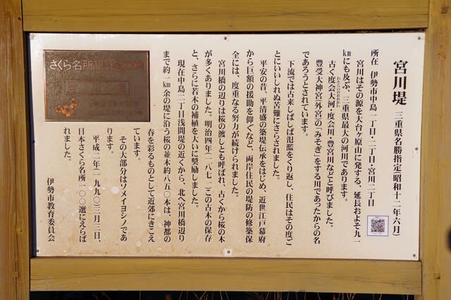
説明版です
宮川堤 三重県名勝指定(昭和12年6月)
所在地 伊勢市中島1丁目・2丁目・宮川1丁目
宮川はその源を大台ヶ原山に発する、延長およそ91kmにも及ぶ、三重県最大の河川であります。
古く渡会大河・渡会川・豊宮川などと呼びました。
豊受大神宮(外宮)の「みそぎ」をする川であったからの名であろうとされています。
下流では古来しばしば氾濫をくり返し、住民はその度ごとにいいしれぬ苦難にさらされました。
平安の昔、平清盛の築堤伝承をはじめ、近世江戸幕府から巨額の援助を仰ぐなど、両岸住民の堤防修築保全には、度重なる努力が続けられました。
宮川橋の辺りは桜の渡しとも呼ばれ、古くから桜の木が多くありました。明治4年(1871)この古木の保存と、さらに若木の補植を大いに奨励しました。
現在中島1丁目浅間堤の近くから、北へ宮川橋辺りまで約1km余の堤に沿う桜の並木約850本は、神都の春を彩るものとして近郷にきこえています。
その大部分はソメイヨシノであります。
平成2年(1990)3月3日、日本さくら名所100選にえらばれました。
伊勢市教育委員会
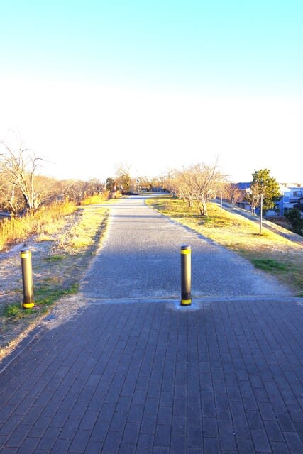
でわ堤の上を北へ進みましょう

約150m程で、目的の「境楠」の樹冠が見えて来ます

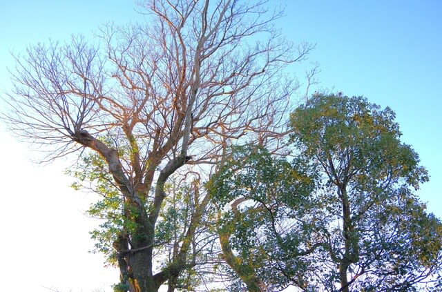
鳥居です、境楠は土手から河原側に下だった所にありますが、葉がありませんね~


土手上から見下ろしました

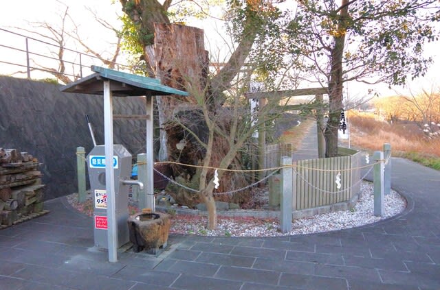
説明版は土手上にあります
市史跡 境楠(さかいぐす)
所在地 伊勢市中島1丁目・宮川2丁目
指定 令和元年7月25日
境楠は、宮川下流域右岸の中島1丁目・宮川2丁目の境に位置しています。
「小祠比路比(しょうしひろい)」という江戸時代の書物によると、北(喜多)家の支配する中島町と榎倉家の支配する中川原町との境を示す木でした。
樹高約10m、胸高周囲8m程の大木となり、昭和33年(1958)い伊勢市の天然記念物に指定しましたが、平成15年(2003)に老衰枯死しました。
それでも「楠大明神」として地域の人々の信仰の対象であり続け、宮川堤の堤防改修時に境楠一帯の環境整備が行われました。
現在は、先代境楠の苗木から二世木が育っており、境楠一帯を史跡に位置付け直し、保護を図っています。
令和3年1月 伊勢市教育委員会


南西側から楠大明神です
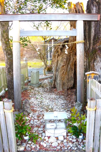
根元の鳥居です


若い二代目が育っています

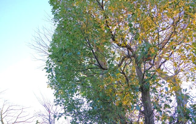
北側から見ました
では、戻って渡会橋の南側に行きましょう
2025・1・26・7・10
中島1丁目は、伊勢市役所の西北西約2kmのところです、宮川堤の駐車場に車を止めて周辺を4回分廻りました
伊勢市役所南側の県道22号線を西へ、約300mの「外宮北」信号を右(北東)へ、県道37号鳥羽松坂線です
約400mのJR参宮線伊勢市駅前で北西に向きを変え
道成りに約2.1kmの「渡会橋東詰」信号を右(北)へ入ると直ぐ左手の
駐車場に入りました周辺観光案内図です、現在地は図の左側、市役所は右側の日陰の部分の伊勢市駅の下側です
「三重県指定 名勝 宮川堤 散策マップ」です、まずは⑨の境楠(市指定)から見て行くことにしました
宮川堤公園案内板です、朝早くから犬の散歩の方々で駐車場も賑わっています
説明版です
宮川堤 三重県名勝指定(昭和12年6月)
所在地 伊勢市中島1丁目・2丁目・宮川1丁目
宮川はその源を大台ヶ原山に発する、延長およそ91kmにも及ぶ、三重県最大の河川であります。
古く渡会大河・渡会川・豊宮川などと呼びました。
豊受大神宮(外宮)の「みそぎ」をする川であったからの名であろうとされています。
下流では古来しばしば氾濫をくり返し、住民はその度ごとにいいしれぬ苦難にさらされました。
平安の昔、平清盛の築堤伝承をはじめ、近世江戸幕府から巨額の援助を仰ぐなど、両岸住民の堤防修築保全には、度重なる努力が続けられました。
宮川橋の辺りは桜の渡しとも呼ばれ、古くから桜の木が多くありました。明治4年(1871)この古木の保存と、さらに若木の補植を大いに奨励しました。
現在中島1丁目浅間堤の近くから、北へ宮川橋辺りまで約1km余の堤に沿う桜の並木約850本は、神都の春を彩るものとして近郷にきこえています。
その大部分はソメイヨシノであります。
平成2年(1990)3月3日、日本さくら名所100選にえらばれました。
伊勢市教育委員会
でわ堤の上を北へ進みましょう
約150m程で、目的の「境楠」の樹冠が見えて来ます
鳥居です、境楠は土手から河原側に下だった所にありますが、葉がありませんね~
土手上から見下ろしました
説明版は土手上にあります
市史跡 境楠(さかいぐす)
所在地 伊勢市中島1丁目・宮川2丁目
指定 令和元年7月25日
境楠は、宮川下流域右岸の中島1丁目・宮川2丁目の境に位置しています。
「小祠比路比(しょうしひろい)」という江戸時代の書物によると、北(喜多)家の支配する中島町と榎倉家の支配する中川原町との境を示す木でした。
樹高約10m、胸高周囲8m程の大木となり、昭和33年(1958)い伊勢市の天然記念物に指定しましたが、平成15年(2003)に老衰枯死しました。
それでも「楠大明神」として地域の人々の信仰の対象であり続け、宮川堤の堤防改修時に境楠一帯の環境整備が行われました。
現在は、先代境楠の苗木から二世木が育っており、境楠一帯を史跡に位置付け直し、保護を図っています。
令和3年1月 伊勢市教育委員会
南西側から楠大明神です
根元の鳥居です
若い二代目が育っています
北側から見ました
では、戻って渡会橋の南側に行きましょう
2025・1・26・7・10