


多田大橋から石道を通リ、猪名川沿いに紫合(ゆうだ)まで歩いてきました。
(2021.09.16)

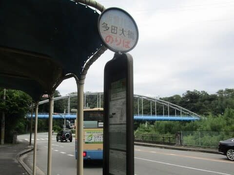
多田大橋BSから出発、猪名川に空色の水管橋が架かっていました。

若宮、岩根山、鳥脇山への道を左に見たところです。川沿いに直進します。

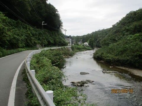
猪名川の清流

虫生(むしゅう)水位流量観測所

銘板の中の位置蘭、多田院「地先」とは、Web国語辞典オンラインによれば
"その土地から先へつながっている場所や地域。番地のない土地の位置を表す
場合にも用いられる " 河川の位置表現でよく見かけます。

地図にある天狗岩はどこでしょう?

猪名川に架かるゴルフ橋、すぐ下流左岸に一庫大路次(ひちくらおおろじ)
川が流入するので、川幅も狭い橋は欄干越えの洪水も度々だそうです。
左にポツンと家並みが…

石道に入り、猪名川支流の野尻川に架かる肝川橋を渡ります。

石道公園で昼食

アズキの花、最近あちこちで見かけます。

石道の広い車道、向こうに新名神が見えます。

猪名川を石道大橋で渡ります。新名神と新旧の対比です。

新名神、西(左)には六石山トンネルがあります。

石道涼風(すずかぜ)橋

猪名川は大きく東へ蛇行します。

六石山の東のこの峠を越えると猪名川町、この先紫合橋を渡って紫合BSへ。


※コメント投稿者のブログIDはブログ作成者のみに通知されます