


三国橋から出発して、猪名川河口横の、旧猪名川水門と排水機場を見てきました。
(2021.08.27)

Google Mapの航空写真を使用しました。(文字は筆者記入)

神崎川下流左岸より眺める大豊橋、対岸は塩野義製薬です。
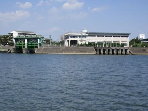
神崎川左岸より眺める、旧猪名川の水門(左)と排水機場(右)

同、水門のアップ

施設の仕組みがよく分かります。
高潮時は水門を閉めて上流域への浸水を防ぎ、上流が洪水増水時はポンプで
溢水を神崎川に放流します。

大豊橋から迂回して水門までやってきました。

水門の銘板です。なんとなく戦前(のことは分かりませんが)の雰囲気です。

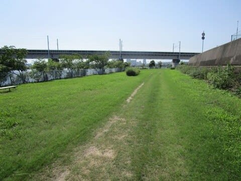
水門からの旧猪名川上流、旧猪名川の始点は豊中市の名神口です。

かっこいいので、もう一度水門を振り返りました。
神崎川右岸沿いを歩いて新幹線をくぐり、猪名川河口に向かいます。

新幹線が通過していきます。

猪名川河口、新幹線橋梁の右に関西ペイントが見えます。

川べりの道が無くなったので、車道に上がります。
右端、猪名川左岸0.0kの表示があります。

前の写真右の白いボックスが水位観測所です。

左は藻川、右が猪名川です。次は、右の戸ノ内橋を渡り、猪名川源流をめざします。
神崎川に流れ込む細流に、群がる小魚を見かけました。 動画


※コメント投稿者のブログIDはブログ作成者のみに通知されます