そろそろレンゲツツジの満開時期だろうかと、6月26日の日曜日に、岡谷市に有る鉢伏山 JA/NN-075 1,929mへSOTA運用に出かけた。
It's about time for the Japanese azalea to be in full bloom, so on Sunday, June 26, we went to Mt.Hachibuse JA/NN-075 1,929m in Okaya City for SOTA activation.
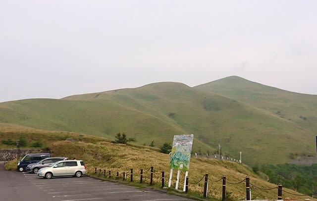
↓駐車場から登山道に出る所。今日は曇り空。少し寒い位。
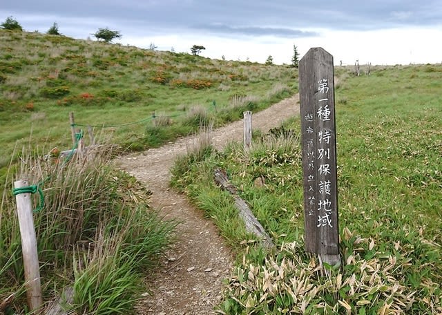
↑Climbing entrance. It's cloudy today. It's a little cold.
↓予想通り登山道沿いにレンゲツツジが沢山咲いている。

↑As expected, many Japanese azaleas are in bloom along the road.
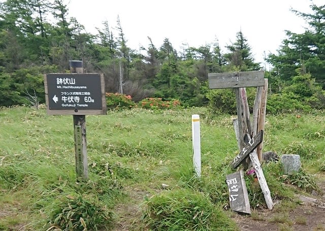
↓少し行くと防災ヘリの墜落現場への分岐点。現場に向けて黙祷する。
↑Branching of disaster prevention helicopter to the accident point.
↓上る途中で山の向こうに虹。レンゲツツジと虹のコラボ!

↑Collaboration of Japanese azalea and rainbow!
↓もうじき山頂。ここ迄あちらこちらでレンゲツツジが満開だ。

↑Near the summit. The Japanese azalea is in full bloom here and there.
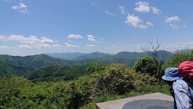
↓山頂到着。鉢伏山の三角点もある。相変わらずの曇り空。
↑Arrive at the top. There is also a triangular point on Mt.Hachibuse.
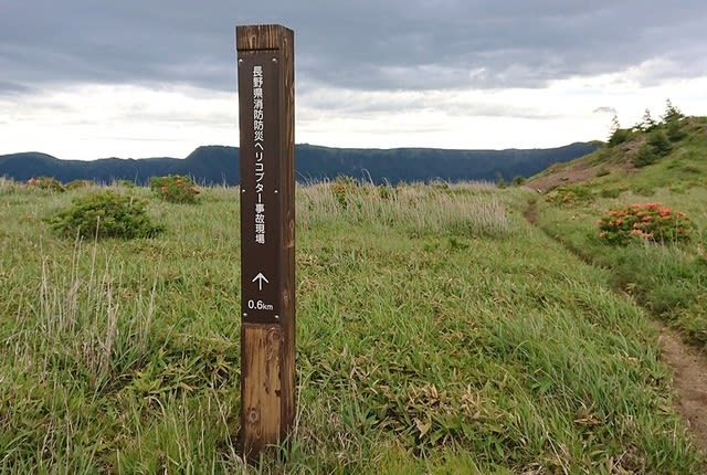
↓ここから更に南の岡谷市最高点へ向かう。

↑From here, head south to the highest point in Okaya City.
↓5分程で岡谷市最高地点、1,936mに到着。なんと小雨が降って来た!

↑Arrive at 1,936m, the highest point in Okaya City. Light rain has come!
少しすると雨は止んだが相変わらず寒い。カッパの下にダウンを着る。
After a while, the rain stopped, but it was still cold.
↓降ってもRIGが濡れないようにシートを掛けられる様に無線機を準備。

↑Prepare the radios by covering a sheet so that RIG will not get wet.
14MHzからCQをだす。国内Esが開けている様で、各エリアから呼ばれる。
Start CQ at 14MHz. Domestic Es is opened. Called from JA's each areas.
18MHz、21MHzでも同様に国内から結構呼ばれた。
18MHz and 21MHz were also called from JA's each areas.
海外は21MHzで、ニュージーとオーストラリアからのコール。
Calls from New Zealand and Australia at 21MHz overseas.
7MHzもCONDX良く、国内からそこそこ呼ばれた。
7MHz is also good CONDX and was called from all over Japan.
↓アンテナと運用風景。

↑Antenna and operation scenery.
XYLの方も順調で、V/Uで楽に規定数はクリア。
XYL is also doing well, and the specified number is cleared by V/U.
↓一通り運用が終わった所で、おにぎりでお昼ご飯。

↑After the operation, we have lunch with rice balls.
かなり寒くて暖かいカップヌードルの方が良いが、持って来なくて残念。
Warm cup noodles are better because it's cold, but today I didn't have.
お昼を食べながら、他の山頂局といくつかS2S-QSO。
While eating lunch, some S2S-QSO with other activators.
その後、XYLの7MHzSSBでのCQでいくつかQSO。
After that, XYL did some QSOs with 7MHz/SSB.
XYLは、8-S2Sを含んで19-QSO程になった。
XYL is about 19-QSOs including 8-S2S-QSOs.
↓7/SSBも終えた所で、機材を撤収。

↑At the end of 7/SSB QSO, the equipment was withdrawn.
↓荷物をまとめて、下山開始。

↑ Pack up our luggage and start descending the mountain.
↓少し西側を通り登山道に戻る途中にもレンゲツツジが満開。

↑The Japanese azalea is in full bloom on the way back to the trail.
↓登山道のレンゲツツジを見ながら下り、無事車に到着。

↑Go down while watching the Japanese azalea and arrive at the car.
本日の結果 Today's result
10MHz/CW 1-QSO S2S(JA)
14MHz/CW 37-QSO S2S=3(JA) included
18MHz/CW 10-QSO
21MHz/CW 9-QSO ZL=1 VK=1 included
7MHz/CW 15-QSO S2S=4(JA) included
144MHz/SSB 1-QSO S2S=1(JA)
433MHz/FM 6-QSO S2S=6(JA)
合計 Total 79-QSO
本日もお相手頂いたor追いかけて頂いた各局様有難うございました。
TNX for all stations who QSO with me or searching for me!
2022.6.26 (6/30 UP)
It's about time for the Japanese azalea to be in full bloom, so on Sunday, June 26, we went to Mt.Hachibuse JA/NN-075 1,929m in Okaya City for SOTA activation.
↓駐車場から登山道に出る所。今日は曇り空。少し寒い位。
↑Climbing entrance. It's cloudy today. It's a little cold.
↓予想通り登山道沿いにレンゲツツジが沢山咲いている。
↑As expected, many Japanese azaleas are in bloom along the road.
↓少し行くと防災ヘリの墜落現場への分岐点。現場に向けて黙祷する。
↑Branching of disaster prevention helicopter to the accident point.
↓上る途中で山の向こうに虹。レンゲツツジと虹のコラボ!
↑Collaboration of Japanese azalea and rainbow!
↓もうじき山頂。ここ迄あちらこちらでレンゲツツジが満開だ。
↑Near the summit. The Japanese azalea is in full bloom here and there.
↓山頂到着。鉢伏山の三角点もある。相変わらずの曇り空。
↑Arrive at the top. There is also a triangular point on Mt.Hachibuse.
↓ここから更に南の岡谷市最高点へ向かう。
↑From here, head south to the highest point in Okaya City.
↓5分程で岡谷市最高地点、1,936mに到着。なんと小雨が降って来た!
↑Arrive at 1,936m, the highest point in Okaya City. Light rain has come!
少しすると雨は止んだが相変わらず寒い。カッパの下にダウンを着る。
After a while, the rain stopped, but it was still cold.
↓降ってもRIGが濡れないようにシートを掛けられる様に無線機を準備。
↑Prepare the radios by covering a sheet so that RIG will not get wet.
14MHzからCQをだす。国内Esが開けている様で、各エリアから呼ばれる。
Start CQ at 14MHz. Domestic Es is opened. Called from JA's each areas.
18MHz、21MHzでも同様に国内から結構呼ばれた。
18MHz and 21MHz were also called from JA's each areas.
海外は21MHzで、ニュージーとオーストラリアからのコール。
Calls from New Zealand and Australia at 21MHz overseas.
7MHzもCONDX良く、国内からそこそこ呼ばれた。
7MHz is also good CONDX and was called from all over Japan.
↓アンテナと運用風景。
↑Antenna and operation scenery.
XYLの方も順調で、V/Uで楽に規定数はクリア。
XYL is also doing well, and the specified number is cleared by V/U.
↓一通り運用が終わった所で、おにぎりでお昼ご飯。
↑After the operation, we have lunch with rice balls.
かなり寒くて暖かいカップヌードルの方が良いが、持って来なくて残念。
Warm cup noodles are better because it's cold, but today I didn't have.
お昼を食べながら、他の山頂局といくつかS2S-QSO。
While eating lunch, some S2S-QSO with other activators.
その後、XYLの7MHzSSBでのCQでいくつかQSO。
After that, XYL did some QSOs with 7MHz/SSB.
XYLは、8-S2Sを含んで19-QSO程になった。
XYL is about 19-QSOs including 8-S2S-QSOs.
↓7/SSBも終えた所で、機材を撤収。
↑At the end of 7/SSB QSO, the equipment was withdrawn.
↓荷物をまとめて、下山開始。
↑ Pack up our luggage and start descending the mountain.
↓少し西側を通り登山道に戻る途中にもレンゲツツジが満開。
↑The Japanese azalea is in full bloom on the way back to the trail.
↓登山道のレンゲツツジを見ながら下り、無事車に到着。
↑Go down while watching the Japanese azalea and arrive at the car.
本日の結果 Today's result
10MHz/CW 1-QSO S2S(JA)
14MHz/CW 37-QSO S2S=3(JA) included
18MHz/CW 10-QSO
21MHz/CW 9-QSO ZL=1 VK=1 included
7MHz/CW 15-QSO S2S=4(JA) included
144MHz/SSB 1-QSO S2S=1(JA)
433MHz/FM 6-QSO S2S=6(JA)
合計 Total 79-QSO
本日もお相手頂いたor追いかけて頂いた各局様有難うございました。
TNX for all stations who QSO with me or searching for me!
2022.6.26 (6/30 UP)