


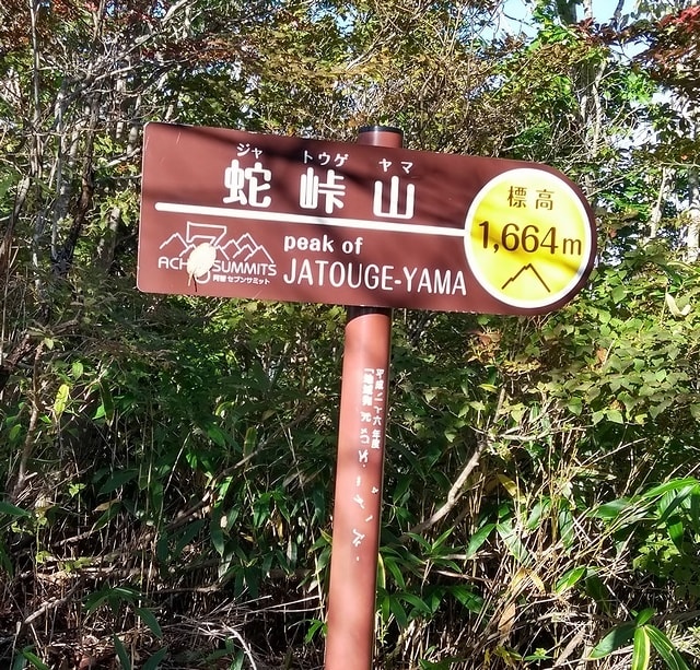
今週末の土曜日は台風の影響で雨だったので、10月11日の日曜日に長野県のほぼ南端にある蛇峠山 1,664m JA/NN-103へSOTA運用に出かけた。
It was raining on Saturday this weekend due to the typhoon, so I went to Jatogeyama 1,664m JA/NN-103 for SOTA activation on Sunday, October 11th.
↓Signboard on the summit of Mt. Jatouge.
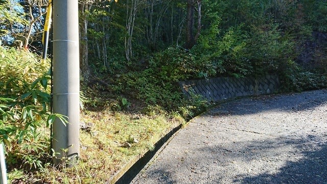
長野県の南端なので、長野市からは、急いでも2時間半ほど掛けて、一番高い登山口の有る馬の背まで来た。
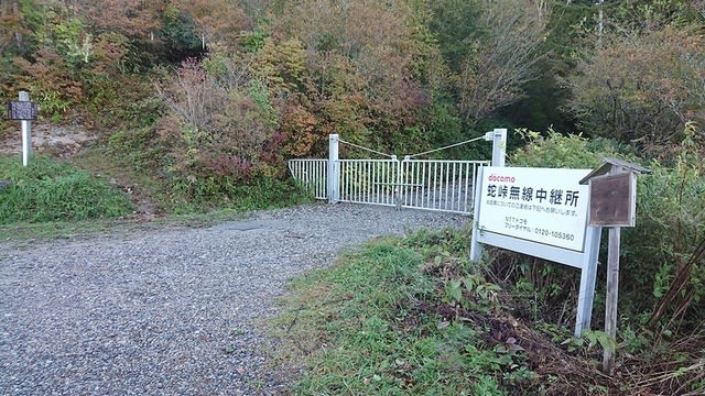
↑Arrived at the "Back of a horse" with a trailhead.
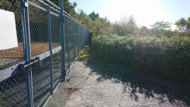
No entry except for permitted vehicles.
ここで、一般車は進入禁止で、ゲートの直ぐ左に登山口がある。
↑There is a trailhead just to the left of the gate.
通常はもう少し下の登山口から登るルートの方がポピュラーの様だ。
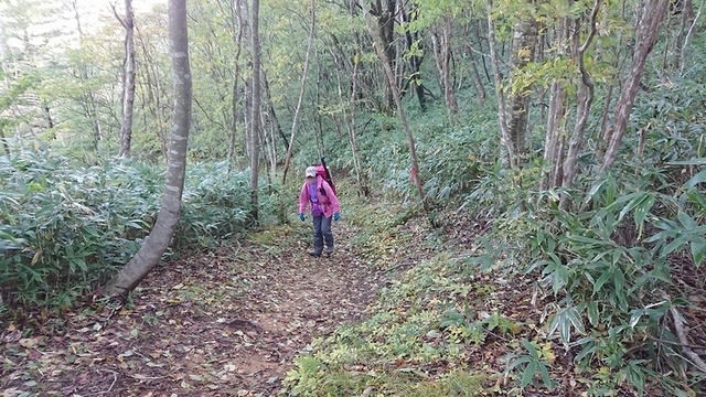
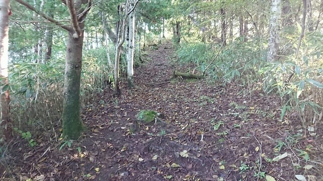
登山道は広く、良く整備されている。
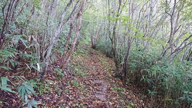
↑The mountain trails are well maintained.
と思ったら、いきなり倒木。
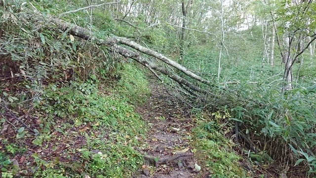
↑There was a fallen tree.
多少、急な登りも有る。
↑There is also a slightly steep climb.
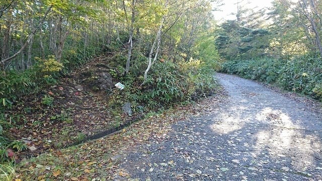
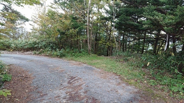
30分程登ると、1回目の林道との合流点に出る。

↑After climbing for 30 min., join the forest road once.
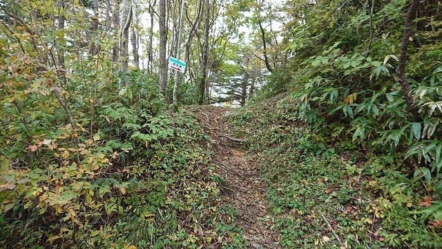
少し林道を歩くと、直ぐ遊歩道の看板で登山道に戻る。
↑Immediately return to the mountain trail at the sign of "promenade"
でっかい石が出てる?
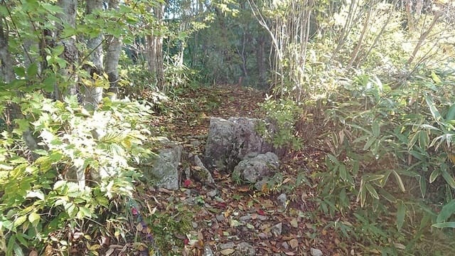
↑There is a huge stone.
5分も歩くと2度目の林道区間に出て10m位で直ぐ登山道に戻る。
↑After walking for 5 min., join the forest road again and immediately return to the mountain trail at about 10m.
多少登りがきつい所も有るが、全体的に登り易い。
↑There are some steep slopes, but overall it is easy to climb.
これ又5分程登ると、3度目の林道に出る。
↑After walking for 5 min., join the forest road again.
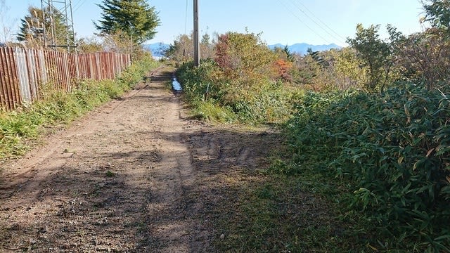
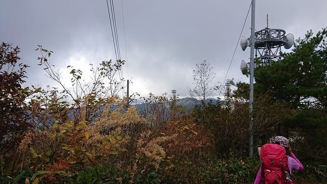
ここからは、中継局の間の舗装路を登って行く。
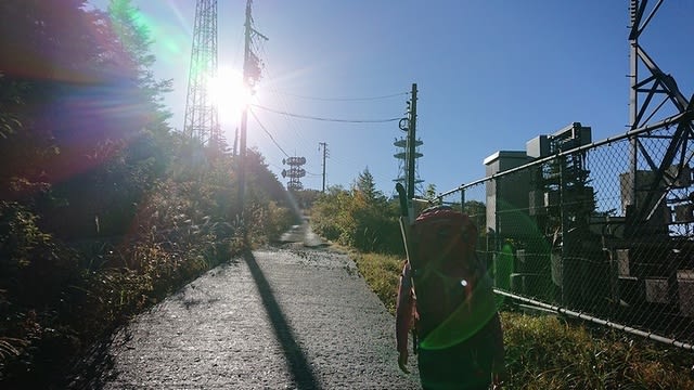
↑From here, climb the paved road between the relay stations.
途中で少し眺めの良い所を通る。どこの山だろうか?
↑On the way, pass a place with a little view.
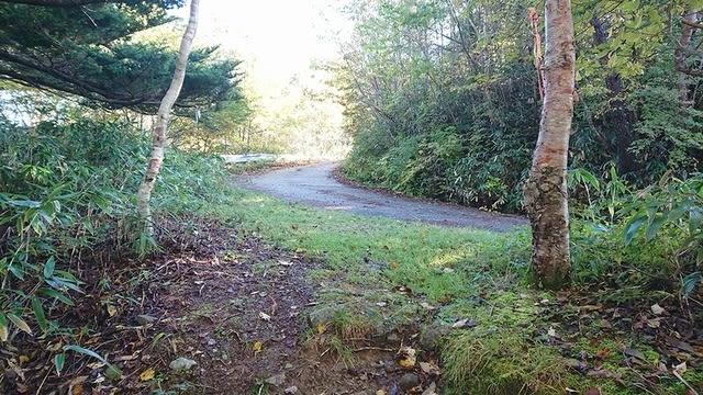
何となく舗装路に沿って歩いていくと、あれっ?行き止まり!
↑Walking along the pavement was a dead end!
道を間違えた様で、ヤマップ地図を見ながら少し戻る。
どうやら、ここで間違えたらしい。左の道に入るのが正解。
↑Maybe I made a mistake here. The correct road is to the left.
この辺は、脇道が出た時に、脇道側の木にピンテが有るか無いかを確認してピンテのある方に進めばいい様だ。
ここは脇道を右に入る。右手前の木にピンテがくっついていた。
↑Turn right here. A pink ribbon was stuck to the tree on the right.
ちなみに、まっすぐ進むとレーダー雨量計のサイトの正面に出る。
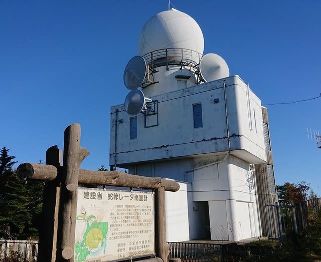
↑Go straight We went to the radar rain gauge site.
登山道は雨量計サイトの直ぐ右横を通っているので、ここは間違えても、直ぐ登山道に戻れる。
雨量計サイトが途切れる辺りで、右横に下る道があるのでそちらへ進む。
↑There is a road down to the right, so go there.
笹藪の間を一旦下って登り返す。

↑Go down between the bamboo bushes and climb back up.
と言っても、しっかり藪は刈られていたので、藪漕ぎはしなくて済んだ。
登り返した先に展望台が見えて来た。
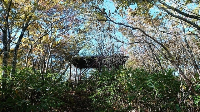
↑The observatory came into view after climbing back.
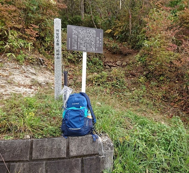
展望台に登ると、その先の下に山頂標識があった。

↑When I climbed the observatory, there was a mountaintop sign below.
ちなみに、もし雨が降ってたら、展望台の下のスペースで雨宿り&運用が出来そうであった。
少し迷った物の、それを含めて1時間で到着。標高差は220m程度。
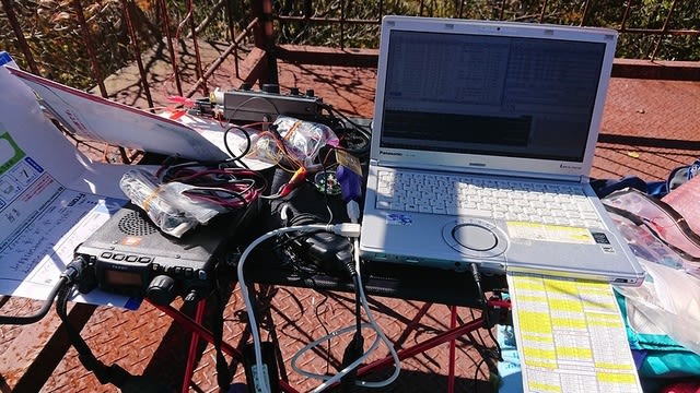
早速、シャックを展開して、運用を始める。

↑Prepare the shack and start operation.
この日、2座予定のIOT局が既に出ていたので、先ずはS2Sゲット。
Get S2S by QSO with the IOT-san at JA/AT-001.
そのままSSBにQSY。XYLもS2Sゲット。Xはこれで秋田駒ケ岳コンプ。
その後いつもの様に14MHzからスタート。
After that, CQ-call started in the 20m band.
ニュージーのBYZ局、オーストラリアのTJ局、北米からも3局のコール。
ただ、何かのDXコンテストと重なってるらしく、TJ局に599を送ったら、コンテストQRM局から「Nr?」を何度も返されて参った。
何のコンテストか不明でNRが判らないので、慌ててQSYした。
後で調べるとオセアニアDXかも。001を送れば良かったかな、、、
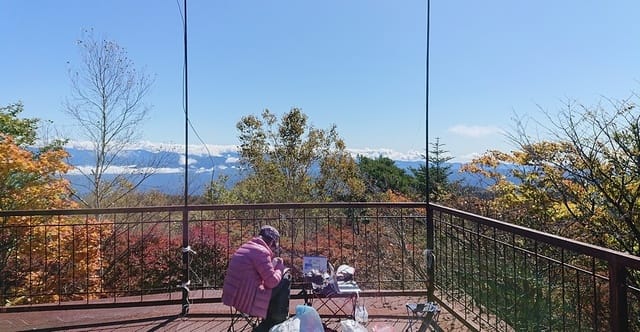
今日の運用風景
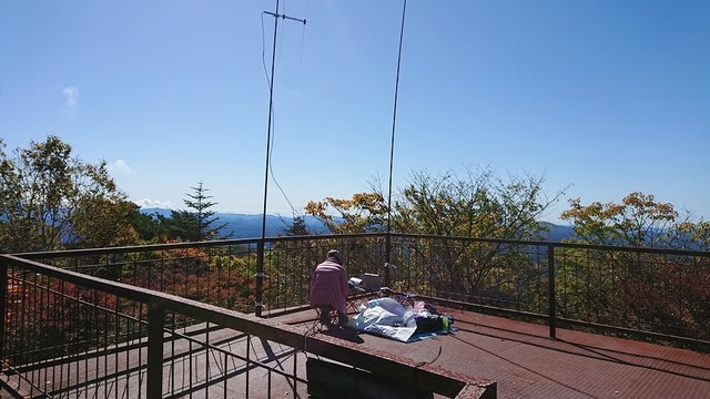
↑Today's operational scene.
21MHzに移りニュージーとオーストラリアからコール。国内も近場と沖縄からコールが有った。
次に7MHzに移るが、ローカルスキップで、GWの2エリア、電離層反射では4,6,7,8のみだった。
一休みして、TXW局が今日の2座目から出ていたので、S2Sコール。
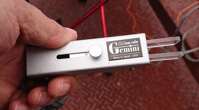
Twitterで関東チェイサー局から2m/CWのリクエストを受けたので、Xの2m/SSBがひと段落した所で、FT-817を借りて、関東にビームを向けCQ。
↑On-air even at 2m/CW using FT-817.
が、関東チェイサー御三家局では、VRY局のみ何とか419でQSO。後の局には届かなかった様である。ちなみに同じ周波数でSSBも出てみた。
その内NAP局の、本日2座目からのSPOT。1座目は聞こえなかったが、少しコンディションが良くなったか、無事にS2Sゲット。
しばらくすると、SO-032に登ったWMN局がTwitterで7MHz周波数を告知。直ぐに行って、これもS2S。ちなみにSO-032はNN-103からは23km程だ。
少しWMN局を聞いているとAWE局の呼ぶ音が529で聞こえる。急いでメッセを送って、7MHzCWでコール。無事にAWE局にはサービスできた。
その後2座目のIOT局とCWでS2S。
この時、ちょっと慌てて、パドルを落っことしたら、短点ばかり出る様になってしまった。ショック!(´;ω;`)
↑I accidentally dropped the paddle and got only the dot continuously.
その後、SSBにQSYしたが、Xは430/FMでCQを出してしまった為、延々呼ばれ続けている。結局こちらは、IOT局のオンエア時間に間に合わず、XはS2Sならず。
本日の結果 Today's result
14MHz/CW 5-QSO 1-ZL1, 1-VK4, 3-USA
21MHz/CW 5-QSO 1-VK1, 1-ZL1含む
7MHz/CW 11-QSO 5-S2S含む
7MHz/SSB 2-QSO
144MHz/CW 2-QSO
144MHz/SSB 1-QSO
合計 26-QSO
展望台からは周りの木が高く、遠くの山も雲が掛かりもう一つの眺め。
↑From the observatory, high trees, and the mountains with clouds, so the view is not good.
ちなみ、本日初使用のイスは強度不足かピン抜けの為か、僅か1回の使用で曲がるは、外れるは、、、安いの買いすぎたな、、、、
↑A new chair broke. Cheap things are no good.
と言う事で、1時を過ぎた所で、お昼ご飯を食べてから撤収。
下山を開始した時には、少し雲行きが怪しくなって来た。
↑When I started descending, clouds came out.
山の上にも黒い雲が、、、、急いで下る。

↑Black clouds on the mountain. Hurry down.
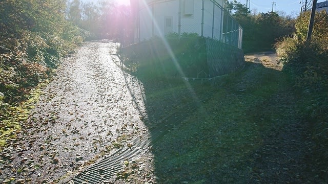
下りの林道から登山道への入り口。ピンテが目印。
↑The entrance from the forest road to the mountain trail.
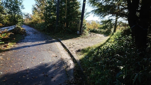
下りの2度目の登山道入り口。遊歩道の看板が目印。
↑The entrance to the second mountain trail.
無事雨に降られずに下山完了。
↑The descent was completed without it raining.
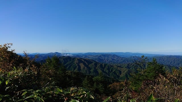
馬の背の駐車場のすぐ下の展望台からの眺め。
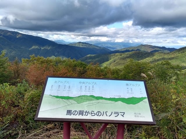
↑View from the observatory on the "Back of the horse".
少し遠くだが、北、中央、南アルプス一望の様だ。
今日は、国内CONDXは今一つだったが、DX CONDXはまずまずだった。
Xは普段繋がらない2エリア3エリアと出来てちょっと楽しそうだった。
お相手頂いたor追いかけて頂いた各局様、どうも有難う御座いました。
Tnx for all stations who QSO or chace with me !
2020.10.11 (10/12 UP)
It was raining on Saturday this weekend due to the typhoon, so I went to Jatogeyama 1,664m JA/NN-103 for SOTA activation on Sunday, October 11th.
↓Signboard on the summit of Mt. Jatouge.
長野県の南端なので、長野市からは、急いでも2時間半ほど掛けて、一番高い登山口の有る馬の背まで来た。
↑Arrived at the "Back of a horse" with a trailhead.
No entry except for permitted vehicles.
ここで、一般車は進入禁止で、ゲートの直ぐ左に登山口がある。
↑There is a trailhead just to the left of the gate.
通常はもう少し下の登山口から登るルートの方がポピュラーの様だ。
登山道は広く、良く整備されている。
↑The mountain trails are well maintained.
と思ったら、いきなり倒木。
↑There was a fallen tree.
多少、急な登りも有る。
↑There is also a slightly steep climb.
30分程登ると、1回目の林道との合流点に出る。
↑After climbing for 30 min., join the forest road once.
少し林道を歩くと、直ぐ遊歩道の看板で登山道に戻る。
↑Immediately return to the mountain trail at the sign of "promenade"
でっかい石が出てる?
↑There is a huge stone.
5分も歩くと2度目の林道区間に出て10m位で直ぐ登山道に戻る。
↑After walking for 5 min., join the forest road again and immediately return to the mountain trail at about 10m.
多少登りがきつい所も有るが、全体的に登り易い。
↑There are some steep slopes, but overall it is easy to climb.
これ又5分程登ると、3度目の林道に出る。
↑After walking for 5 min., join the forest road again.
ここからは、中継局の間の舗装路を登って行く。
↑From here, climb the paved road between the relay stations.
途中で少し眺めの良い所を通る。どこの山だろうか?
↑On the way, pass a place with a little view.
何となく舗装路に沿って歩いていくと、あれっ?行き止まり!
↑Walking along the pavement was a dead end!
道を間違えた様で、ヤマップ地図を見ながら少し戻る。
どうやら、ここで間違えたらしい。左の道に入るのが正解。
↑Maybe I made a mistake here. The correct road is to the left.
この辺は、脇道が出た時に、脇道側の木にピンテが有るか無いかを確認してピンテのある方に進めばいい様だ。
ここは脇道を右に入る。右手前の木にピンテがくっついていた。
↑Turn right here. A pink ribbon was stuck to the tree on the right.
ちなみに、まっすぐ進むとレーダー雨量計のサイトの正面に出る。
↑Go straight We went to the radar rain gauge site.
登山道は雨量計サイトの直ぐ右横を通っているので、ここは間違えても、直ぐ登山道に戻れる。
雨量計サイトが途切れる辺りで、右横に下る道があるのでそちらへ進む。
↑There is a road down to the right, so go there.
笹藪の間を一旦下って登り返す。
↑Go down between the bamboo bushes and climb back up.
と言っても、しっかり藪は刈られていたので、藪漕ぎはしなくて済んだ。
登り返した先に展望台が見えて来た。
↑The observatory came into view after climbing back.
展望台に登ると、その先の下に山頂標識があった。
↑When I climbed the observatory, there was a mountaintop sign below.
ちなみに、もし雨が降ってたら、展望台の下のスペースで雨宿り&運用が出来そうであった。
少し迷った物の、それを含めて1時間で到着。標高差は220m程度。
早速、シャックを展開して、運用を始める。
↑Prepare the shack and start operation.
この日、2座予定のIOT局が既に出ていたので、先ずはS2Sゲット。
Get S2S by QSO with the IOT-san at JA/AT-001.
そのままSSBにQSY。XYLもS2Sゲット。Xはこれで秋田駒ケ岳コンプ。
その後いつもの様に14MHzからスタート。
After that, CQ-call started in the 20m band.
ニュージーのBYZ局、オーストラリアのTJ局、北米からも3局のコール。
ただ、何かのDXコンテストと重なってるらしく、TJ局に599を送ったら、コンテストQRM局から「Nr?」を何度も返されて参った。
何のコンテストか不明でNRが判らないので、慌ててQSYした。
後で調べるとオセアニアDXかも。001を送れば良かったかな、、、
今日の運用風景
↑Today's operational scene.
21MHzに移りニュージーとオーストラリアからコール。国内も近場と沖縄からコールが有った。
次に7MHzに移るが、ローカルスキップで、GWの2エリア、電離層反射では4,6,7,8のみだった。
一休みして、TXW局が今日の2座目から出ていたので、S2Sコール。
Twitterで関東チェイサー局から2m/CWのリクエストを受けたので、Xの2m/SSBがひと段落した所で、FT-817を借りて、関東にビームを向けCQ。
↑On-air even at 2m/CW using FT-817.
が、関東チェイサー御三家局では、VRY局のみ何とか419でQSO。後の局には届かなかった様である。ちなみに同じ周波数でSSBも出てみた。
その内NAP局の、本日2座目からのSPOT。1座目は聞こえなかったが、少しコンディションが良くなったか、無事にS2Sゲット。
しばらくすると、SO-032に登ったWMN局がTwitterで7MHz周波数を告知。直ぐに行って、これもS2S。ちなみにSO-032はNN-103からは23km程だ。
少しWMN局を聞いているとAWE局の呼ぶ音が529で聞こえる。急いでメッセを送って、7MHzCWでコール。無事にAWE局にはサービスできた。
その後2座目のIOT局とCWでS2S。
この時、ちょっと慌てて、パドルを落っことしたら、短点ばかり出る様になってしまった。ショック!(´;ω;`)
↑I accidentally dropped the paddle and got only the dot continuously.
その後、SSBにQSYしたが、Xは430/FMでCQを出してしまった為、延々呼ばれ続けている。結局こちらは、IOT局のオンエア時間に間に合わず、XはS2Sならず。
本日の結果 Today's result
14MHz/CW 5-QSO 1-ZL1, 1-VK4, 3-USA
21MHz/CW 5-QSO 1-VK1, 1-ZL1含む
7MHz/CW 11-QSO 5-S2S含む
7MHz/SSB 2-QSO
144MHz/CW 2-QSO
144MHz/SSB 1-QSO
合計 26-QSO
展望台からは周りの木が高く、遠くの山も雲が掛かりもう一つの眺め。
↑From the observatory, high trees, and the mountains with clouds, so the view is not good.
ちなみ、本日初使用のイスは強度不足かピン抜けの為か、僅か1回の使用で曲がるは、外れるは、、、安いの買いすぎたな、、、、
↑A new chair broke. Cheap things are no good.
と言う事で、1時を過ぎた所で、お昼ご飯を食べてから撤収。
下山を開始した時には、少し雲行きが怪しくなって来た。
↑When I started descending, clouds came out.
山の上にも黒い雲が、、、、急いで下る。
↑Black clouds on the mountain. Hurry down.
下りの林道から登山道への入り口。ピンテが目印。
↑The entrance from the forest road to the mountain trail.
下りの2度目の登山道入り口。遊歩道の看板が目印。
↑The entrance to the second mountain trail.
無事雨に降られずに下山完了。
↑The descent was completed without it raining.
馬の背の駐車場のすぐ下の展望台からの眺め。
↑View from the observatory on the "Back of the horse".
少し遠くだが、北、中央、南アルプス一望の様だ。
今日は、国内CONDXは今一つだったが、DX CONDXはまずまずだった。
Xは普段繋がらない2エリア3エリアと出来てちょっと楽しそうだった。
お相手頂いたor追いかけて頂いた各局様、どうも有難う御座いました。
Tnx for all stations who QSO or chace with me !
2020.10.11 (10/12 UP)


※コメント投稿者のブログIDはブログ作成者のみに通知されます