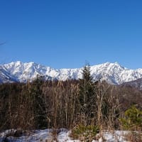
On Sunday, May 21, I headed for JA/NN-080 Mt. Mitsumine in Nagawa-town, but I gave up at the trailhead due to strong gas and wind, and went to JA/NN-101 Takamatsuyama 1,670m in the same Nagawa-town. and SOTA activated.
↓三峰山の登山口は強い風と濃いガスに包まれていた。

↑The trailhead of Mt.Mitsumine was wrapped in strong wind and thick gas.
一時間ほど様子を見たが一向に天候は変わらないので目的地を変更。
I waited for about an hour, but the weather did not change at all, so I changed the destination.
↓JA/NN-101高松山に登る事に。登山口は快晴である。

↑To climb Mt. Takamatsu JA/NN-101. The weather is fine at the trailhead.
↓予定より遅れて登山開始。入り口には大きな石が。

↑Start climbing later than planned. There is a large stone at the entrance.
↓まずは真っ直ぐと林道を登っていく。

↑First, go straight up the forest road.
↓途中、蕨がところどころ生えていた。

↑Warabi was growing here and there on the way.
↓林道の途中に倒木。手前と奥にももう一本。

↑A fallen tree in the middle of a forest road.
↓暫く登ると変則X字路。左上へ進んでいく。

↑After climbing for a while, I came to an irregular X-shaped road. Go to the upper left.
↓今度は右手前上に向かって林道を進む。

↑This time, follow the forest road toward the upper right front.
↓途中から林道を離れ、カヤト藪の手前まで進む。

↑Leave the forest road on the way and proceed to the front of the Kayato grove.
↓カヤト藪の手前を大きく西に回り込んで、尾根筋に出る。

↑Walk around in front of the Kayato grove and reach the ridgeline.
↓尾根筋から見た車山のレーダーサイト。でも手前にゲレンデ?

↑Radar site of Mt. Kuruma seen from the ridgeline. But is the slope in front?
おかしいと思ったら、ゲレンデは手前の高山のゲレンデだった。
I thought it was strange, the ski slope was the slope of Mt.Takayama in front.
↓尾根筋を進むと、SOTAポイントが見えてきた。

↑I go along the ridge, I can see the SOTA point.
↓SOTAポイントに到着。

↑Arrive at the SOTA point.
岩の上に荷物を置いて地面をよく見るとなんとアリの大群が一面に歩いている。
When I put my luggage on the rock and looked closely at the ground, I saw a large group of ants walking all over.
↓慌てて荷物を持って、少し東の高松山三角点に移動。

↑I hurriedly grabbed my luggage and moved to the Takamatsuyama triangulation point.
↓ここで無線機の準備。

↑Prepare the radio here.
今日は14MHzからスタート。
Today started from 14MHz.
国内Esが開けているようで、国内局からボチボチ呼ばれる。
It seems that the domestic Es is open, and the domestic stations calling.
18MHzはオーストラリアからコールと国内Esも開けている。
18MHz is also open domestic Es. Calls from Australia and JA.
↓今日のアンテナ

↑Today's Antenna
21MHzは台湾と国内Esだ。
21MHz is call from Taiwan and JA Es.
24/28MHzは時間も遅いせいか誰にも呼ばれなかった。
24/28MHz was too late, so no one called me.
↓山頂は風が強く時々釣り竿が倒れそうになる。

↑The wind is strong at the summit and sometimes the fishing rod is about to fall over.
一通りハイバンドを終えて、7MHzに降りるが、こちらはさっぱり呼ばれない。
After finishing the high band, I went down to 7MHz, but I was not called.
時々、430MHzのFM局のS2Sを拾いながら本日の運用は終了。
Today's operation ended while occasionally picking up S2S of 430MHz FM.
↓運用を終えてお昼ご飯。

↑Lunch after operation.
今日の山頂は風は強いが、日差しもあるので寒くない。
The wind is strong at the summit today, but there is sunshine, so it's not cold.
↓荷物を撤収して下山開始。

↑Put away my luggage and start descending.
↓下りはカヤト藪を横切る形で真っ直ぐ降りる。

↑The descent goes straight across the kayato grove.
↓無事に舗装道路まで下山。

↑Descend to the paved road.
↓本日の登山ルート。登りが1.5H、下り1Hだった。

↑Today's climbing route. It was 1.5H uphill and 1H downhill.
今日は三峰山登山口で時間をロスしたから、運用時間が遅かったせいか、24/28MHzが坊主。
0-QSO at 24/28MHz today, because I lost time at the trailhead of Mt.Mitsumine.
ハイバンドが開ける季節は終了したかなぁ、、、
I wonder if the season when the high band opens is over,,,
本日の結果 Today's result
14MHz/CW 8-QSO S2S(JA)=2 included
18MHz/CW 2-QSO VK=1 S2S(JA)=1
21MHz/CW 3-QSO BV=1 S2S(JA)=1 included
24MHz/CW 0-QSO
28MHz/CW 0-QSO
7MHz/CW 7-QSO S2S(JA)=6 included
144MHz/FM 1-QSO
430MHz/FM 2-QSO S2S(JA)=2
合計 Total 23-QSO
本日もお相手頂いたor追いかけて頂いた各局様有難うございました。
TNX for all stations who QSO with me or searching for me!
2023.5.21 (5/31 UP)


