↓駐車場から見た一夜山山頂方向
↑Mt.Ichiyasan peak seen from the parking.
カーナビには道は出てこないのだが、舗装の林道を過ぎ、更にダートの林道の終点まで行き、丁度明るくなる頃に、一夜山駐車場に到着。
ここの駐車場は虫が多いとwebに書いていた。
I heard that there are many bugs in the parking lot here.
パワー森林香↓と
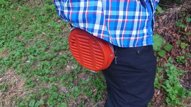
↑Equipped with a strong insect repellent spiral incense.
顔に掛ける虫よけ網↓を準備。
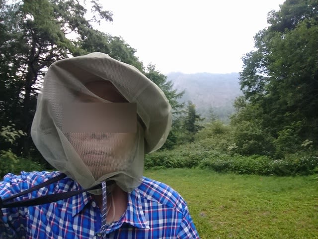
↑Equipped with an insect repellent face net.
靴の履き替えも、車の中で行なう。
と言う事で準備万端で登山開始。

↑Start climbing from the signboard at the climbing mouth.
登山道はかなり広い道で、重機なら上がれそう。

↑The trail is wide road.
途中で白い小さな花が咲いていた。

↑White flowers were blooming.
紫の花も咲いている。シャジンの仲間かな?

↑Purple flowers were blooming.
45分ほど歩くと、山頂まで500mの看板が出た。
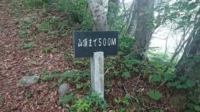
↑After walking for about 45 minutes, a 500m signboard came out.
更に12分ほど歩いて、300mの看板が出てきた。

↑After walking for about 12 minutes, a 300m signboard came out.
300mの看板を過ぎると登りがかなりきつくなる。

↑The slope becomes steep after passing the 300m sign.
残り100mの看板までの200mに18分掛かり、ここ迄1時間15分。

↑Took 18 minutes to reach the 100m sign.
やっと山頂の神社が見えてきた。

↑The shrine of the mountaintop appeared.
山頂到着。山頂はガスの中である。
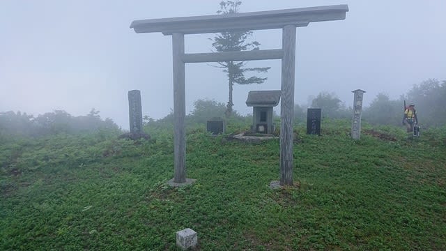
↑Arrived at the summit. It is in the fog.
登り始めから1時間20分ほど掛かった。
Climbing total time is 1 hour 20 minutes.
ここは展望が良い山頂と聞いて居たので、少し残念である。
山頂をうろうろしていると靴にシロヒトリがくっつく。

↑Shirohitori(A kind of moth) stays on the shoes.
森林香にやられたのか、あまり動かなかった。
と言う事で、機材をそうそうに設置する。

↑Prepare antenna and radio.
2mの2エレHB9CVと430の5エレを上げる。HFは8m長のLW-Ant。
まずはすでにオンエアしているBOK局をコールしてS2Sゲット
その後、14MHzからスタート。今日は久々にアメリカから呼ばれた。それも3局も!さらにオーストラリアからも呼ばれた。
続いて21MHzに上がるがZLは無しで、GWでの伝搬のみ。CONDX悪い?
7MHzに上がるが、それ程CONDXは良くない感じ。
一通り終わった後は、他局の山頂からの電波を待ち、S2Sを3局ほどゲットして終了。
本日のシャック。

↑Today's shack.
本日の結果
14MHz/CW 7-QSO USA-3局、VK-1局含む
21MHz/CW 2-QSO
7MHz/CW 15-QSO S2S 3局含む
7MHz/SSB 1-QSO S2S
144MHz/FM 1-QSO
合計 26-QSO
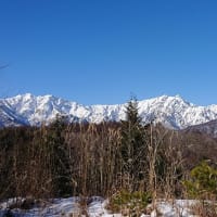
次第に山頂も晴れてきて、周辺の山が見えてきた。

↑It became clearer and the neighboring mountains came into view.
しかし晴れると今度は暑い。低山はつらい。
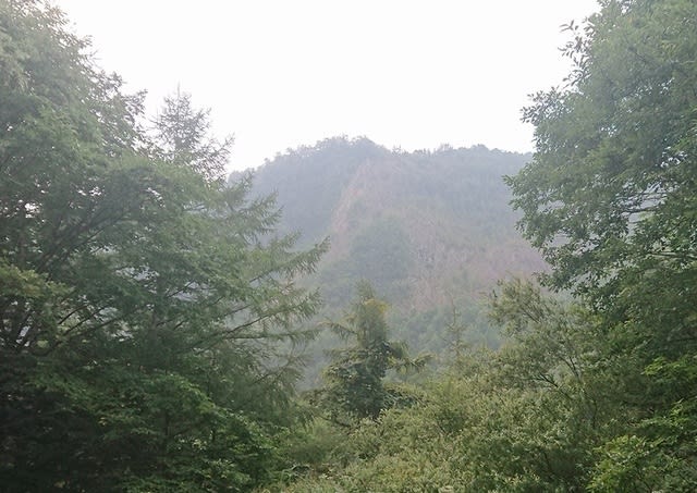
遠くの山は雲がかかってる。雨が降ってるのかなぁ?

↑Clouds hang over mountains in the distance. Is it raining?
と言う事で12時前に昼食を食べて、12頃にはほぼ撤収完了。

↑Lunch was finished around 1200JST and withdrawal was completed.
山頂から少し降りた所で、隣の山が見える所が有った。

↑Can see the near mountain on my way down the mountain.
行きは曇ってて全く見えなかったが、、、
と言う事で、スタート地点のゲートまでやっと降りてきた。

↑Came down to the trailhead.
降りてくるとアブをはじめ虫がすごく寄ってくる。
There were a lot of tabanid flies in the parking lot.
急いで荷物を車に放り込んで、車の中に入り込む。
そのすきにも車の外だけでなく、車の中にもたくさんアブが入ってしまう。
I entered the car in a hurry, but many tabanid flies entered the car.

いつもは、登山靴を履き替えて帰るのだが、取り敢えず、登山靴を履いたままで、虫よけ網もかぶったまま、駐車場を出る。
Start the car without removing the face net.
時々窓を開けて中のアブをタオルで外に追い出しながら林道を進む。
何とか県道迄戻ってしばらく行った辺りで、車を降りて中のアブを全て追い出して、やっと平和な車内となった。
When I arrived at the wide road, I stopped the car and drove out the tabanid flies in the car.
そのまま、しばらく走って、最初の自動販売機の所に車を止めて水分補給と靴を履き替えて、無事に帰途につきました。
いや~、アブが凄いとは聞いて居たが、ここ迄とは、、、
参った参った。ここは夏はやめて、秋以降か春先が良いかも。
お相手頂いた各局様、今回もQSO頂き有難うございました。
Tnx for all stations who QSO with me !
2020.8.22 (8/24 UP)