On Saturday, October 31st, I went to the SOTA activation at Mt.Mushikurayama 1,659m JA/NN-219 in JCG09012H, Nagawa-Town.
↓Mt. Mushikurayama is famous for producing obsidian.

虫倉山に行くには、いくつかルートが有るが、今回は黒曜石ミュージアム近くの林道から入り、星糞峠を経由するルートで行く事とする。
ちなみに、星糞とは、黒曜石の事らしい。
先にルートと書いたが、ここも先週の高松山と同じく、星糞峠から先の登山道がはっきりしない。
As with Mt.Takamatsuyama, the mountain trail is not clear here.
と言う事で、今回もGPSとにらめっこしながらの登山となる。
↓林道の入り口 Forest road entrance.

↓星糞峠までは、広い林道を歩いていく。

↑Walk along a wide forest road to Hoshikuso Pass.
↓20分ほど歩くと星糞峠の大き目の東屋に到着。トイレも有る。

↑After walking for 20mi., arrive at Azumaya at Hoshikuso Pass.
体験ミュージアムの外部施設としての東屋らしい
↓ここから上は遺跡になっているらしい。看板の間を登って行く。
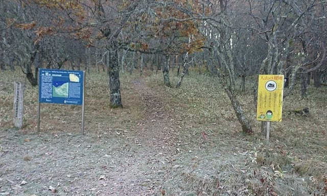
↑Climb between the signs.
↓途中に遺跡の発見順の番号と思われる、番号付きの玉が刺さってる。
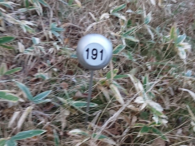
↑The number in the order of discovery of the ruins, is stuck on the way.
↓番号付きの玉をいくつか見ながら登ると、その上には何やら建物。

↑Climb while. There is a hut for archaeological excavation.
遺跡の発掘基地だろうか?
↓そこから更に上に登って行く。

↑Climb further up.
↓尾根筋を目指して笹藪の坂を登って行く。
↑Climb the slope of the bamboo bush toward the ridge.
↓途中の小さなピークには大きな岩がある。

↑There is a large rock at a small peak on the way.
↓岩の横に通じるロープを伝って、尾根筋まで登る。

↑Use the rope to climb up to the ridge.
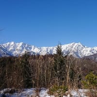
↓無事に尾根筋に出る。朝日も登って来た。

↑It appears safely on the ridge. The rising sun.
↓尾根を進むと、木の上に何やら鳥の巣状のものが!

↑There is something like a bird's nest on the tree!
これはひょっとして熊棚??
Is this a bear shelf ??
↓稜線を進むと虫倉山の直ぐ西のピークが見えて来た。

↑The peak just west of Mt. Mushikura was appeared.
↓このピークから少し南の方向の鷹山が見える。

↑Can see Mt.Takayama in the south direction.
↓少し西には鷲ヶ峰も見える。

↑West direction, can see Mt.Washigamine.
↓虫倉山は、この西ピークから一旦下りカヤト藪を抜けて行く。

↑Go down from the west peak and go through the Kayato bush.
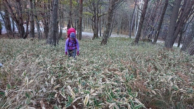
↓背丈ほどの藪を歩く。踏み跡は無数にあるが正解が判らない。

↑Walk in the bush as tall as I am.
↓なんとかカヤト藪を抜けると林の中の登りになる。

↑After passing through the Kayato bush, climb in the forest.
↓山頂到着。三角点を発見。

↑Arrived at the summit. I found a triangulation station.
↓その先には祠が有った。

↑There was a shrine beyond that.
↓山頂の気温は2℃ほど。結構寒い。

↑The temperature at the summit is about 2℃. It's cold.
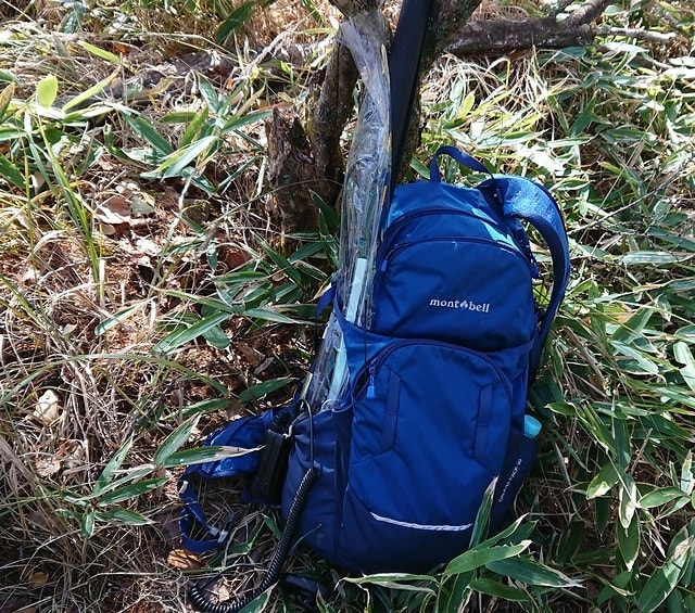
↓早速機材を展開。

↑Prepare the radio.
先ずは、14MHzから開始。
北米から1局コールが有ったが、他は国内局。
21MHzもZL1から1局のみで、今日はDXは低調だ。
21MHzではBOK局からS2Sコールを受けた。
その後7MHzでCQを出す前にJMN局のスポットを見つけ14MHzでS2S。
7MHzでは微妙な開け具合。韓国からのコールも有った。
ひとしきり終えた所で、OOP局の14MHzのスポットを聞きに行くと、OOP局は聞こえないが、未交信の北米局が聞える。
もしかしてと、再度14MHzにスポットを上げてCQをだすと、上手くその北米局が来てくれた。
↓2mのアンテナ

↑2m antenna.
ちなみに、V/UHFの方は、何やら強力な感度抑圧を受けてる様で、さっぱり聞こえて来ない。
やっとの事で5局だとか、、、、
本日の結果 Today's result
14MHz/CW 7-QSO NA:2 S2S:1 含む
21MHz/CW 4-QSO ZL1:1 S2S:1 含む
7MHz/CW 12-QSO HL:1 含む
合計 Total:23-QSO (4-DX 2-S2S)
天気は快晴なのだが、林の中は日差しが弱く、結構寒い。
The WX is fine, but the sunlight is weak in the forest. So cold.
↓お湯を沸かして、カップヌードルを頂く。
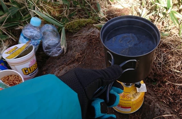
↑Boil water and eat cup noodles.
↓食べ終わってから機材を撤収して下山開始。
↑After eating, withdraw the equipment and start descending.
↓先ずは林の中の低い笹藪を下る。

↑First, go down the low bamboo bush in the forest.
↓続いて、カヤトの藪を突っ切る。

↑Then cross the bush of Kayato.
↓樹林帯との境を歩こうと来たルートより少し北寄りを下る。

↑Go down a little north of the route you came from.
↓少し行くと作業道?が出たので、歩いていくと倒木が道をふさぐ。

↑After a short walk, a work road came out, and as I walked, fallen trees blocked the road.
↓倒木を避けながら進むが、倒木が多すぎて進めない所も。
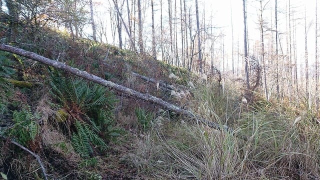
↑There are places where there are too many fallen trees to proceed.
↓倒木を避けて少し下に降りるが、だんだん来た道から離れてく。

↑Avoid the fallen trees and get off, but gradually move away from the road you came from.
↓急な斜面をトラバースしてなんとか朝来た尾根に出る。

↑Traverse the steep slope to the ridge that came in the morning.
尾根からの下りも少し迷いながらなんとか星糞峠に戻り林道を行く。
↓途中少し傾いた日差しを受けたススキがきれいだった。

↑The pampas grass that received the sunlight was beautiful.
↓と言う事で何とかゲートまで無事に辿り着いた。

↑Arrived at the gate safely.
↓下山ルートは、尾根筋を北側に外れたら、散々なルートで一苦労。

↑The downhill was off the ridge from north, so it's difficult route.
お相手頂いた局長様、追いかけて頂いた局長様、どうもありがとうございました。
Tnx for all stations who QSO with me !
2020.10.31 (11/4 UP)