↓Park my car beside the forest road at the trailhead.

登山口付近に6時半に到着。林道わきに車を停めて登山口を探す。
なにやら、草ぼうぼうの登山口を発見。いやな予感がする。

↑Found a mountain trail with a lot of grass!
案の定、少し進むと笹と草がぼうぼうでやぶ漕ぎ状態。
道を間違えたかと一度戻るが、間違っていない様だ。
更に進むと、登山道を示すように木にマーキングを発見。

↑Row a bush, found a marking paint for the mountain trail.
しかし、そこまでの道もそこからの道もさっぱりわからない。
諦めて一旦戻る事にした。
Gave up and go back to the trailhead.
スキー場の方に戻って、ゲレンデ歩きで登る事にする。

↑Climb from the ski slopes.
真ん中あたりのピークが山頂の様である。
ゲレンデの下から見ると、物凄い急登である。

↑Saw from the slope bottom, it is a tremendous climb.
余りに急登なので、もう一つ左のゲレンデから登る事にした。
しかし、こちらも、草ぼうぼうである。

↑There were more than 1m of grass on the slopes!
草に足を取られながら、暫らく登ると、紅輪タンポポが咲いていた。
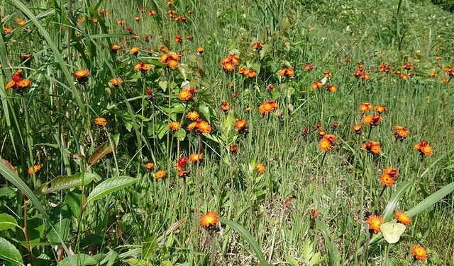
↑Kourin dandelion flowers were blooming.
更に登ると、今度は、アヤメが咲いていた。

↑Climbed further, Iris flowers were blooming.
45分程登ると第1クワッドリフトの駅に到着。ここで少し休憩。
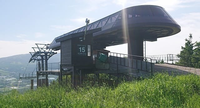
↑Climb about 45min., arrive at the Lift Station.
結構日差しが強く、大汗をかく。リフトの日陰で水分補給。
15分程休憩して、再び登り出す。あと半分位か?

↑After 15min. break, start climbing again. Rest was half?
頂上までもう一息。

↑A little more to the summit.
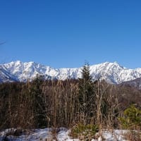
やっと山頂に到着!休憩を入れて1時間半かかった。
↓正面左の頂が、JA/NN-207 根子岳、右の頂は、JA/GM-001 四阿山。

↑Arrived at the summit!
Left peak is JA/NN-207 Mt.Neko. Right peak is JA/GM-001 Mt.Azumaya.
小屋の少し奥の方に三角点を発見。

↑Found a top mark.
既に時間は9時半を回っている。予定より2時間以上遅れている。
急いでアンテナ他機材を準備する。
運用を開始できたのは、10時半過ぎである。

↑Prepare the antenna and other equipment. Start around 01:30 UTC.
今日はかなり出遅れたので、初めにSW3をみて、S2Sを探しに行く。
先ずはNN-195のWMN局発見。続いて、YN-059のDGT局、更にKT-006のNAP局と立て続けにS2Sゲット。KT-001のWLQ局、KN-022のCJH局は残念ながら聞こえない。
可能性のありそうなSPOTを確認し終わって、14MHzからスタート。
真っ先にニュージーランドのZL1BYZ局からコール頂いたが、こちらのレポートを送った後、向うのレポートが返ってこない。何度か再送したが、残念ながらレポート確認できず。
コンディションが落ちたかな、、、今日は時間が少し遅いからなぁ、、、
14MHzで数局交信後、21MHzに移る途中で、SW3でAT-126のIOT局を発見。
7MHzにチューンを取り直して無事S2Sゲット。
こういう時、ATUは素早くバンドチェンジ出来て助かるよね!
↓本日のシャック

↑Todays' shack.
21MHzに移り北海道のUCI局とQSO後、GM-013のAWE局からコールでS2S。
次に7MHzに移るが、こちらは2局のみ。時間が遅くて余り開けていない?
そろそろお昼と思っている所で、転がしてあったDJ-G7に何やら入感。
NN-059湯ノ丸山のNCT局だ。慌ててG7を持ってXYL共々1.2G/S2Sゲット。
ここで一旦お昼ご飯。コンビニおにぎりを頂く。
昼食後50MHzに移るとEsが開けている。取り敢えず北海道局とQSO。
その後2mに上がったが、SOTA Spotterがエラーを返しSPOTが出来ない。
ならばと、ブラウザからSW3を開いてSPOTしようとするが、SPOT画面まで行って動かなくなりSPOT出来ない。
諦めて暫らく144/CWでCQを出したが、やはり周波数情報のSPOT無しでは広いV/UHFのバンド内でCQを拾って貰え無いので今日はこれで終了。
撤収して、14時過ぎに下山開始。
↓下りも草深いゲレンデを下る。
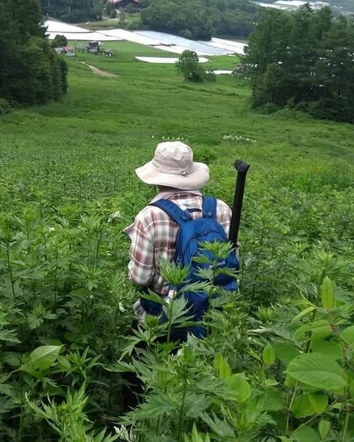
↑The downhill was also a tall grass slope.
下りは45分程で車までたどり着いた。

↑I got to the car in 45min down the slope.
本日の結果
7MHz/CW 5-QSO 3-S2S
14MHz/CW 5-QSO
18MHz/CW 1-QSO 1-S2S
21MHz/CW 2-QSO 1-S2S
50MHz/CW 3-QSO
144MHz/CW 0-QSO
1.2G/FM 1-QSO 1-S2S
合計 17-QSO、6-S2S(Sammit to Sammit 山頂同士の通信)
今日は局数が少なかった割にS2Sが沢山稼げて先ず先ずと言った所。
お相手頂いた各局様、いつもQSO有難うございました。
Tnx for all stations who QSO with me !
↓本日のコース

↑Today's root.
2020.6.27 (6/29 UP)