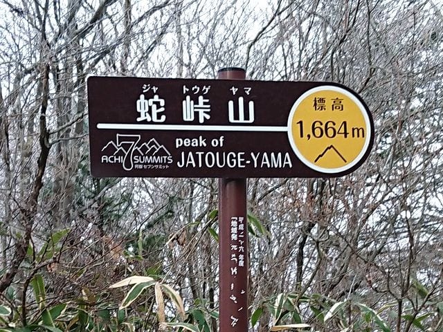
On Saturday, December 3rd, I went to Jatogeyama between Achi village and Anan town for SOTA activation. My wife is on a mountaineering trip today, so I went alone.
↓馬の背先のDocomoゲート脇から登る。

↑Climb from the side of the Docomo gate on the "Back of the horse".
↓霜柱が長く伸びている。

↑Frost columns are growing long.
↓登り始めて直ぐに倒木。長物(ANTと竿)を持ってるのでくぐるのは大変。

↑Fallen tree soon after starting to climb. It's hard to pass through because I have a long object (ANT and pole).
↓整備された登山道を登る。

↑Climb the maintained mountain trail.
↓一旦舗装の林道に合流。電柱の先で、また登山道に戻る。
↑Join the paved forest road once. Immediately return to the trail.
↓再び舗装林道に出る。

↑Return to the paved forest road again.
3回目の舗装林道に出てからは、林道を進む。
After coming out to the paved forest road for the third time, proceed along the forest road.
↓林道沿いの木に霧氷が少しついている。

↑There is a little frost on the trees along the forest road.
↓アップにするとこんな感じ。

↑It looks like this when zoom in.
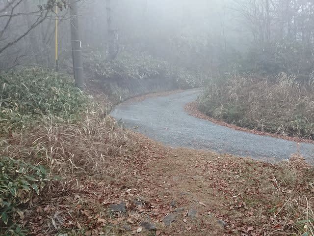
↓ここから左の方に曲がって登る。
↑From here, turn left and climb up.
↓先の電柱の手前を右に曲がる。

↑Turn right in front of the pillar ahead.
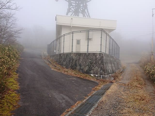
↓雨量観測所の脇を通る。

↑Pass by the rainfall observatory.
↓観測所の横辺りで右下の笹藪の方に降りる。

↑At the side of the observatory, go down to the bamboo grove on the lower right.
↓あまり笹藪が刈られていなくて、はみ出している。

↑The bamboo grove is not cut so much and it sticks out.
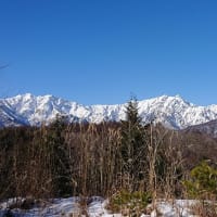
↓しばらく行くと山頂の展望台が見えて来た。

↑ After a while, the observatory at the top of the mountain came into view.
↓山頂到着。今日は53分程掛かった。

↑Arrive at the summit. It took 53 minutes today.
↓暫らく展望台は登れ無かった様だが階段の「KEEP OUT」のテープは切られてる。

↑It seems that couldn't climb the observation deck for a while, but the "KEEP OUT" tape has been cut.
下をよく見るが特に修理されて様な跡は見つけられなかった。
I looked closely at the bottom, but I couldn't find especially repaired.
↓登ってみて特に不安定さは無かった。山頂はガスの中で展望なし。

↑There was no particular instability when I climbed. The summit has no view in the gas.
↓山頂の気温は氷点下0.6度。

↑The temperature at the summit is -0.6°C.
ガスの中で日も差さないのでかなり寒い。
It's pretty cold because the sun doesn't shine in the gas.
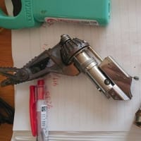
↓無線機の準備をする。

↑Prepare the radio.
今日は21MHzからCQスタート。
CQ started from 21MHz today.
北米、台湾、ニュージーからコール。
Calls from North America, Taiwan and New Zealand.
18MHzでは北米からのコール。
Calls from North America on 18MHz.
14MHzは国内の局が少しのみ。
14MHz has only a few domestic stations.
7MHzの国内CONDXはまずまず良かった。
Domestic CONDX of 7MHz was reasonably good.
↓アンテナはこんな感じ。

↑Today's antenna.
一通り運用を終えたので、お湯を沸かしてお昼ご飯にする事に。
I finished the operation, so I boiled water and have lunch.
↓ガーン!!お湯が沸く頃に、カップヌードルを忘れた事に気が付く!

↑OMG! ! By the time the water boils, I realize I forgot my cup noodles!
往路のコンビニで買った昼飯一式車に置いて来たみたいだ。
It seems that I left the lunch set I bought at the convenience store on the way out in the car.
下山するまで昼飯抜きだ!(涙)
No lunch until I descend!
↓暇なので下に降りて展望台を確認すると一つターンバックルが外れている。

Because I'm free, I went down and checked the observatory, and one turnbuckle was off.
どうも、これがしばらく立ち入り禁止だった理由だろうか?
Could this be why it was "Keep OUT" for a while?
沢山人が上がってくるとちょっと危ないかも。
It might be a little dangerous when a lot of people come up.
↓お昼過ぎは少し晴れて、多少暖かくなって来た。

↑ It was a little sunny in the afternoon, and it got a little warmer.
↓S2Sが概ね終わった所で、腹も減ったので撤収して下山する。

↑ When S2S was almost over, I was hungry, so I withdrew and descended.
今日はストックも忘れたので、下りはゆっくり。
I forgot my stock today, so I went down slowly.
↓やっと先に駐車場の車が見えて来た。

↑I finally saw a car in the parking lot.
↓車まで帰着。

↑Return to the car.
↓やっとお昼ご飯に有りつける。(笑)

I finally have lunch. (smile)
と言う事で、今日は昼飯、ストック、汗拭きタオルを忘れて、山頂でひもじい思いをした。
With that said, I forgot lunch, stock, and a sweat towel today, and felt very hungry at the top of the mountain.
次回は忘れ物に気を付けて登り始めよう。
Next time, let's start climbing without forgetting anything.
本日の結果 Today's result
21MHz/CW 10-QSO ZL=1 W=4 BV=2 include
18MHz/CW 4-QSO W=1 S2S=2(JA) include
14MHz/CW 2-QSO
7MHz/CW 22-QSO S2S=8(JA) include
7MHz/SSB 3-QSO S2S=3(JA)
430MHz/FM 3-QSO S2S=3(JA)
合計 Total 44-QSO
本日もお相手頂いたor追いかけて頂いた各局様有難うございました。
TNX for all stations who QSO with me or searching for me!
2022.12.03 (12/5 UP)