On Sunday, September 25th, I went to Omatsuyama JA/NN-109 1,649m at Sugadaira Kogen in Ueda City for SOTA activation. This time, XYL was going to Mt.Azumaya with her friends of the mountaineering club, so I climbed alone.
↓これから登る大松山。ゲレンデの頂上だ。

↑View of Omatsuyama from below. It's the top of the slope.
↓途中テープが沢山張られてコースが作られている。

↑A lot of tape is stretched on the way and some kind of course is made.
来週開かれる「パインビークフリーライド」と言う、オフロードバイクの走行会の様だ。
It's like next week's "Pinebeak Freeride", an off-road bike race.
今週でなくて良かった。
I'm glad it wasn't this week.
↓ゲレンデの途中に咲いていた白い花。終わりかけている、、、
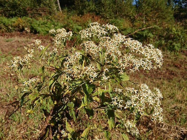
↑A white flower blooming in the middle of the slope. it's about to end...
↓ムラサキツメクサの仲間??
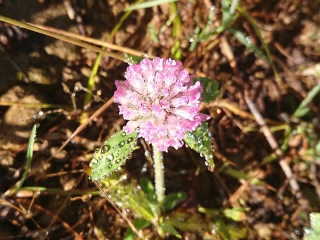
↑A kind of red clover??
↓途中からゲレンデから林道に入る。
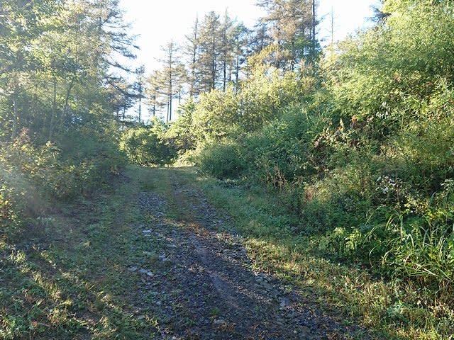
↑From the middle, enter the forest road from the slope.
↓昨夜、結構雨が降った様で、水たまりが出来ている。

↑It rained a lot last night and there are puddles.
↓最後の区間は林道からゲレンデに戻る。

↑The last section returns from the forest road to the slopes.
ゲレンデはかなり急で、なかなか登れない。林道を歩いた方が良かったみたいだ。
Because the slope is steep, you can only climb a little at a time. It seems that it was better to walk on the forest road.
↓やっと山頂到着。65分程掛かった。昨年は林道歩きで55分だった。
↑Arrive at the summit. It took 65 min. Last year it was 55 min using a forest road.
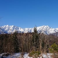
↓山頂から見た根子岳方面。
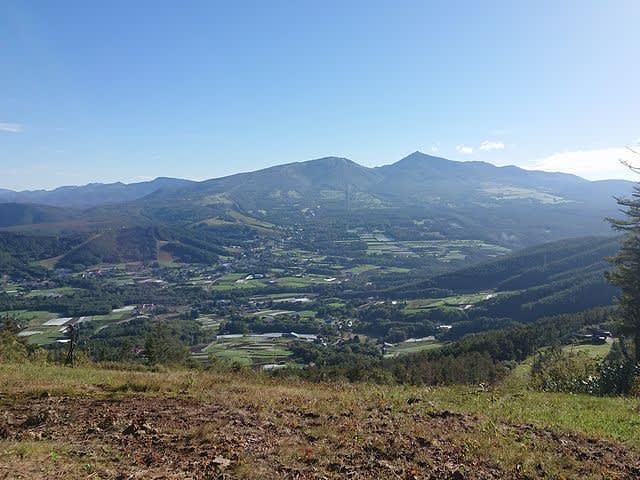
↑The direction of Mt.Nekodake seen from the summit.
↓さっそく無線機を準備。

↑Prepare the radio.
しかし、今日はKX2のATUの調子が悪い。なぜか上手くチューニングできない。
However, today the KX2's ATU is acting weird. I can't tune.
TWで呟くとAWE局からバッテリーの抜き差しをしてみると治るかも?と。
When I wrote in TW, AWE-san suggested removing and inserting the battery once.
試しに、電池を抜き差しすると無事にチューニングが取れる様になった。
After removing and inserting the battery, I was able to tuning without any problem.
う~ん、何だったんだろう。CPUの暴走かなぁ???
Hmmm, what was it? Is it CPU runaway? ? ?
暫らく無線をしていると、何やら爆音が下の方から響いて来た。
After QSO for a while, an explosion sounded from below.
↓どうやら、来週のイベントの試走でモトクロッサーが数台上がって来た。

↑Apparently, a few motocrossers came up on the test run for next week's event.
その後も何台かバイクが上がったり下りたりして少しうるさかったが、お邪魔しているのはこちらなのでしょうがない所だ。
After that, some bikes went up and down and it was quite noisy, but it can't be helped.
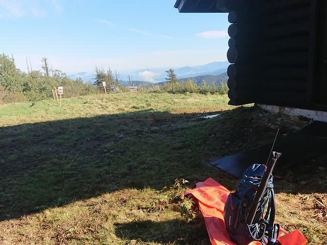
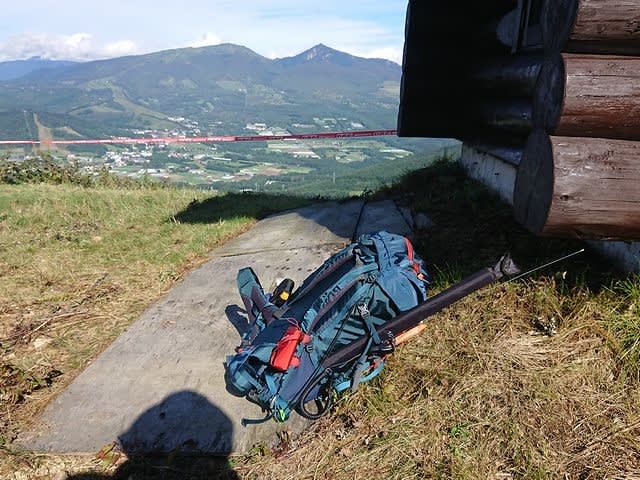
↓この日のアンテナは、小屋に縛り付けて設置。
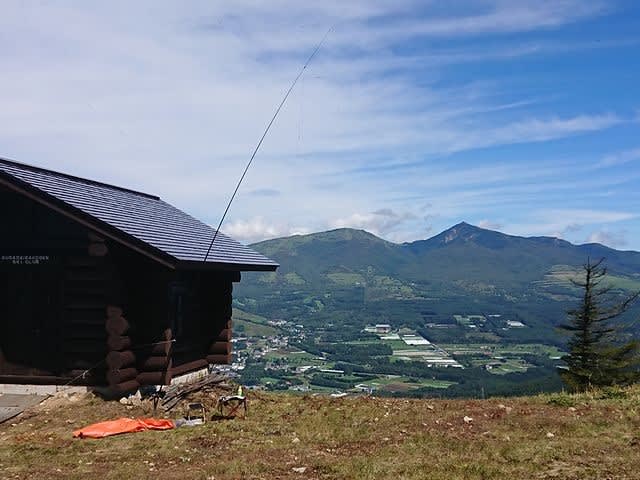
↑The antenna of this day was installed by tying it to the hut.
一通りHFが終わった後は、お昼を食べながらSW3のSPOTを見てS2S稼ぎ。
After the HF was over, I watched SPOT of SW3 while eating lunch and aimed at S2S.
↓V/UのSPOT時には、少しでも高い三角点の所まで歩いて行きQSOする。

↑At the V/U SPOT, walk to a triangulation point as high as possible and make a QSO.
暫らくすると、VU用のDJ-G7のバッテリーも切れ、KX2のチューニングも再び取れなくなり、電源抜き差しでも治らなくなった。
After a while, the DJ-G7 battery for VU ran out, and I couldn't tune the KX2 again.
↓仕方なく撤収。

↑reluctantly withdrawn.
↓荷物をまとめて下山開始。帰りは林道から帰ろう。
↑Pack my zack and start descending. Let's go back down using the forest road.
↓下山途中で、林道で見かけたキノコ。

↑Mushrooms I saw on the forest road on the way down.
↓無事に車に到着。ストックは出したまま置き忘れていたが、そのままだった。

↑Arrive at car. The stock had been left outside the car, but it was still there.
今日はKX2が壊れて、ちょっとショック。バイクもうるさかったし、、、、
My KX2 broke down today, so I was a little shocked. And the bike was too noisy...
本日の結果 Today's result
14MHz/CW 0-QSO
18MHz/CW 3-QSO W=1 included
21MHz/CW 2-QSO S2S=1(JA) ZL=1 included
7MHz/CW 18-QSO S2S=8(JA) included
7MHz/SSB 1-QSO S2S=1(JA)
144MHz/FM 2-QSO S2S=2(JA)
430MHz/FM 4-QSO S2S=4(JA)
合計 Total 30-QSO
本日もお相手頂いたor追いかけて頂いた各局様有難うございました。
TNX for all stations who QSO with me or searching for me!
2022.9.25 (10/01 UP)