https://goo.gl/5eaEDr : Western Samar in general
https://goo.gl/cJy7MK : Catbalogan in general
https://goo.gl/03pdYZ : 12 things to do in Catbalongan
Above 3 shortened URLs carry rather mundane information, the 3rd in particular. Who wants to do caving? I do not. On the other hand you cannot always get information on fishing trips and island hoppings.
What you really need to do, therefore, is to form an impression on this vast area from various sources and at the end of the day conduct your own information gathering, by actually visiting the area and by talking to people there.
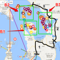
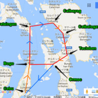
Following clickable Google map is meant for assisting you in that direction.
Inland sea of Samal (coined): https://goo.gl/DRSx4V (now available for universal viewiing)
This is still very much under construction and is expanding day by day. Clickable sea routes will generally give you information on boats, either ferry or bangka boats.
Markers on each island are meant to give you a lot more information, sometimes even you tube movies. Positions and colours of the marker does not mean much, except that they are about the island they are placed on.
Yellow coloured inverted tear drops contain You tube movies and those in chocolateow contain still pictures.
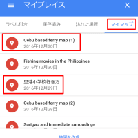
Following map, actually a world map, is very, very useful to find minor ferry routes in the Philippines. I came across this by accident.
(World map, btu very details and useful in finding minor ferry routes)
I have been particularly impressed by the articles on the island of Biliran, by a Pilipina motor bike rider. I think they are superb. The same girl also contributed two articles on her experience with the island of Bohol, as follows.
Articles on Bohol motorbike tour: https://goo.gl/01iYPc
I myself did my own motor bike tour of Bohol in April 2016 and yet the area covered by her is a lot more extensive, beautifully narrated.
You will be able to find her other articles within the island markers.


※コメント投稿者のブログIDはブログ作成者のみに通知されます