


2022年3月20日(日)
【奥三界岳】 岐阜県・長野県 1,811m(未踏)
◎参加者 ソロ
◎アクセス 夕森公園奥の林道ゲート手前まで自家用車
◎地図 ガイドブック 岐阜県の山

◎山登り
晴れ~曇り ジャケット~ウインドブレーカー~シャツ
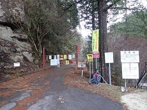
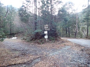
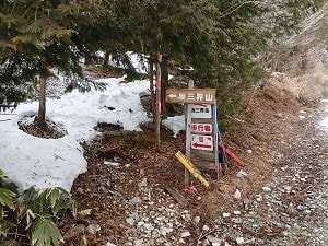
7:12 林道ゲート
夕森キャンプ場を通り過ぎて進むと林道入り口にゲートがある。
その手前に駐車場。わりと広いが、自分の車のみ。
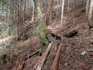
ゲート脇から林道を進む。落石が多い。

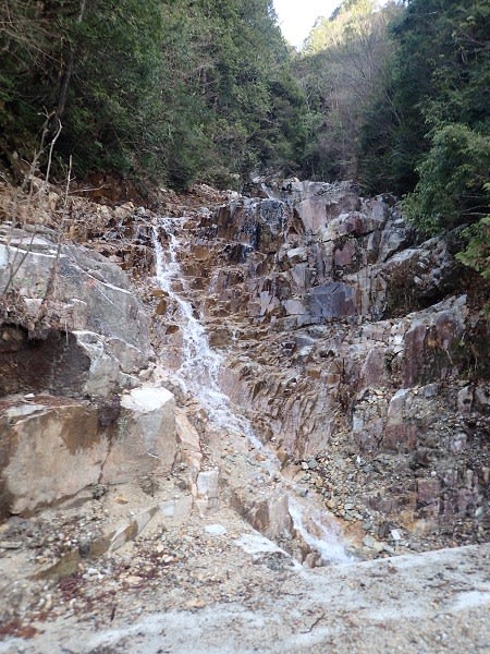
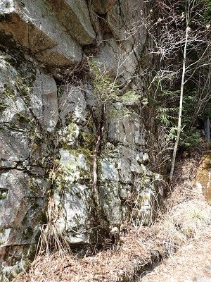
7:18 忘鱗の滝
林道左脇に滝。右側は川上川。
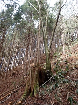
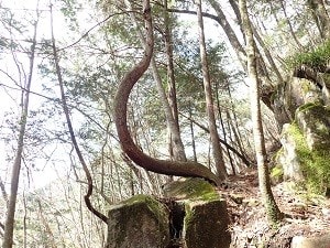
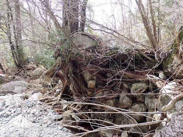
滝を過ぎて少し進むと広場があり不思議な木がある。
老桜の根元からスギが生え一体化、さらにその幹からサワラが芽生えた。
1本の幹に3種類の木が生えている。

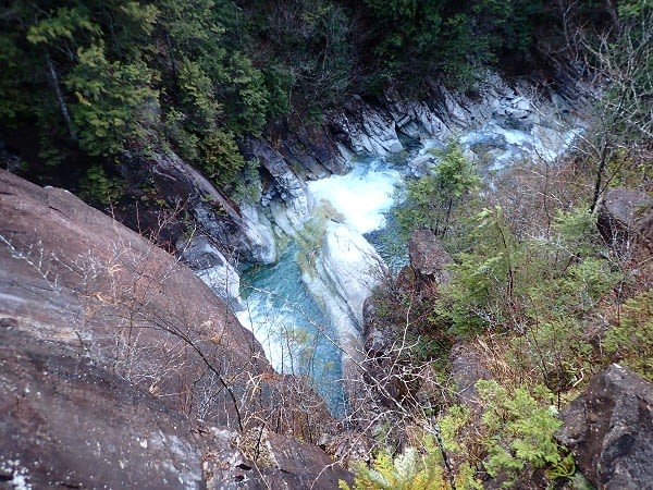
7:36 銅穴の滝
ほどなくまた滝が現れる。
7:42 登山道入り口
看板に従い林道から離れて登山道へ入る。一旦下って川を吊り橋で渡る。
吊り橋は表面が滑りやすく、少し危険。

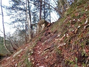
7:59 標識
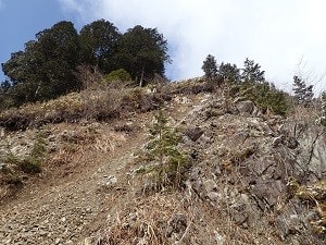
よく整備された登山道とは言えないが、標識やピンクのテープは多く、迷うようなことはない。
ジグザグの登山道を登る。

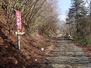
8:54 林道合流
1時間ほど急な登山道を登ると林道に合流する。しばらくは歩きやすい道を進む。
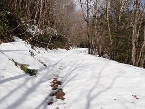
林道が分岐しているところから先はしっかり積雪。チェーンスパイクを装着して進む。

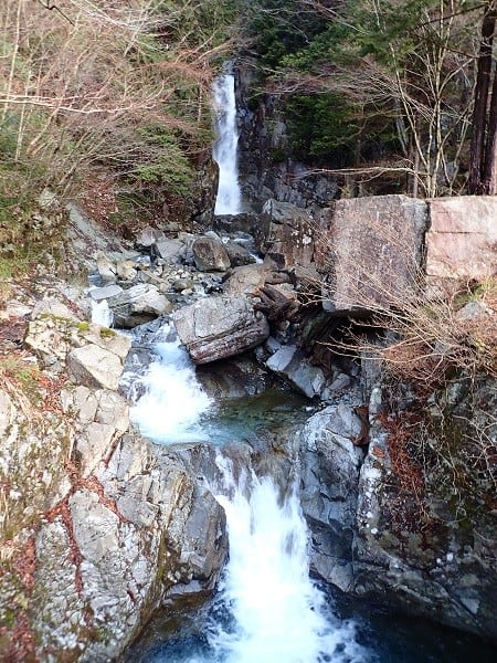
9:53 ショートカット登山道
昇竜の滝の手前に上部の林道へのショートカットの登山道あり。
登り始めたが、積雪が深く装備不足のため登山断念。

林道に戻って昇竜の滝まで進む。ガイドブックでは滝の手前に木製の廃橋が写っているが、現在はコンクリートの橋台が残っているのみ。ショートカットの登山道を行かないと上の林道にたどり着けなくなっている。

滝を眺めて来た道を戻る。この辺りも落石が多い。

10:59 登山道入り口
林道から再び登山道に入る。

12:28 林道入り口
車を停めた林道入り口の駐車場に戻る。
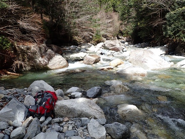
駐車場の奥から河原に降りられた。石に腰掛けインスタントラーメンで昼食。
◎感想・反省
夏に向けてのトレーニング開始。ペットボトルの水で荷物を14kgに調整して登山。
ストックと膝サポーターで膝の痛みはなし。
標高1200mより上はしっかりと積雪。今日の靴とズボンは積雪仕様ではなかったので無理せずに引き返した。
それでも5時間以上歩いたので、それなりのトレーニングにはなった。
◎おまけ
登山中に見つけた変な木の写真。


【奥三界岳】 岐阜県・長野県 1,811m(未踏)
◎参加者 ソロ
◎アクセス 夕森公園奥の林道ゲート手前まで自家用車
◎地図 ガイドブック 岐阜県の山
◎山登り
晴れ~曇り ジャケット~ウインドブレーカー~シャツ
7:12 林道ゲート
夕森キャンプ場を通り過ぎて進むと林道入り口にゲートがある。
その手前に駐車場。わりと広いが、自分の車のみ。
ゲート脇から林道を進む。落石が多い。
7:18 忘鱗の滝
林道左脇に滝。右側は川上川。
滝を過ぎて少し進むと広場があり不思議な木がある。
老桜の根元からスギが生え一体化、さらにその幹からサワラが芽生えた。
1本の幹に3種類の木が生えている。
7:36 銅穴の滝
ほどなくまた滝が現れる。
7:42 登山道入り口
看板に従い林道から離れて登山道へ入る。一旦下って川を吊り橋で渡る。
吊り橋は表面が滑りやすく、少し危険。
7:59 標識
よく整備された登山道とは言えないが、標識やピンクのテープは多く、迷うようなことはない。
ジグザグの登山道を登る。
8:54 林道合流
1時間ほど急な登山道を登ると林道に合流する。しばらくは歩きやすい道を進む。
林道が分岐しているところから先はしっかり積雪。チェーンスパイクを装着して進む。
9:53 ショートカット登山道
昇竜の滝の手前に上部の林道へのショートカットの登山道あり。
登り始めたが、積雪が深く装備不足のため登山断念。
林道に戻って昇竜の滝まで進む。ガイドブックでは滝の手前に木製の廃橋が写っているが、現在はコンクリートの橋台が残っているのみ。ショートカットの登山道を行かないと上の林道にたどり着けなくなっている。
滝を眺めて来た道を戻る。この辺りも落石が多い。
10:59 登山道入り口
林道から再び登山道に入る。
12:28 林道入り口
車を停めた林道入り口の駐車場に戻る。
駐車場の奥から河原に降りられた。石に腰掛けインスタントラーメンで昼食。
◎感想・反省
夏に向けてのトレーニング開始。ペットボトルの水で荷物を14kgに調整して登山。
ストックと膝サポーターで膝の痛みはなし。
標高1200mより上はしっかりと積雪。今日の靴とズボンは積雪仕様ではなかったので無理せずに引き返した。
それでも5時間以上歩いたので、それなりのトレーニングにはなった。
◎おまけ
登山中に見つけた変な木の写真。