「気象操作」-聞き慣れない言葉と思う方も多いだろう・・・。
漠然とそうとしか思えない方も増えて来た・・・!
とにかく、
昨今の気象は不自然に激しすぎる。
台風5号が最長寿台風になるかもしれない?!
既に発生して10日過ぎた。
発生から10日間勢力を維持する台風は1割に満たない。
間違いなく、
あと5日間は勢力温存するのは必至だろう。
最長寿台風は約19日間だと記録にある様であるから、
それを抜く可能性がある。

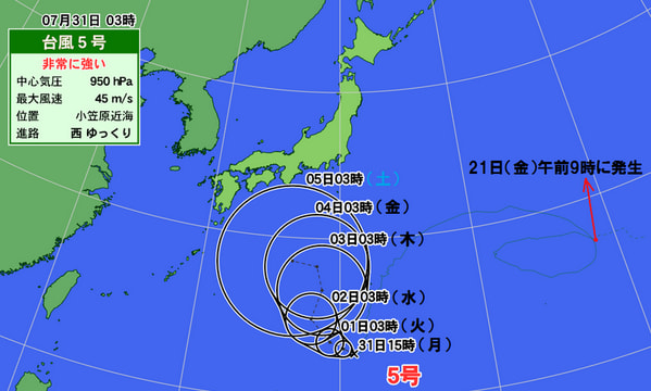

本土直撃乃至は太平洋沿岸を掠める公算が高くなっている・・・。
北海道辺りまで寿命を保てば、
最長寿台風になる可能性が高い・・・。
いずれにしても記録的な台風になる見通しである。

もはや、
迷走ぶりは記録的台風である。

さて、
本題の「気象操作」についてであるが、
先の記事でも書いたことがあるが、
個別具体的に書くことは難しい・・・。
そう簡単には相当因果関係を特定できないのであるからである。
その歴史も長くなると、
一定の現象証拠が出揃ってくる。
類推的見通しも立てやすくなるのである。
悉く、
歴史的気象現象は「気象操作」に依るとの、
類推が立つ。
今回は、
NASA画像に依る「気象操作」に関する論説である。
ご精読あれ!
2017年迷走台風第5号
【転載開始】
NASA Satellite Pictures Prove Our Weather Is Manipulated
By: Dane Wigington via geoengineeringwatch.org
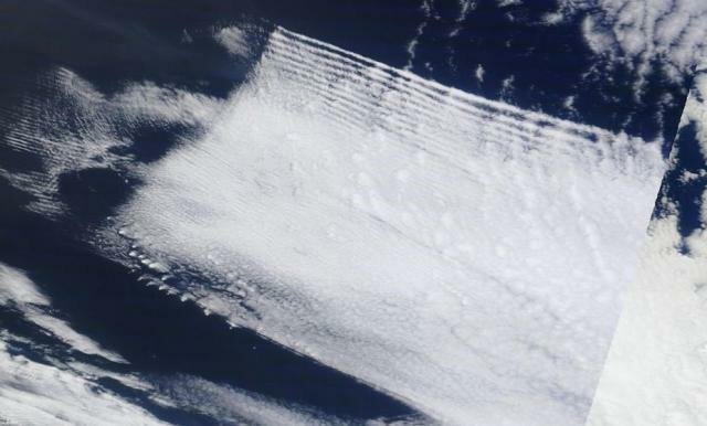
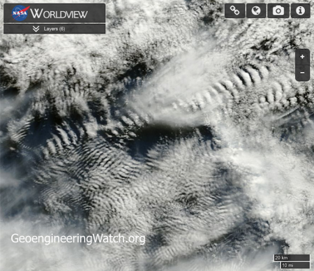
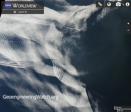
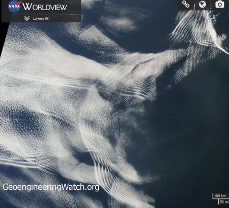
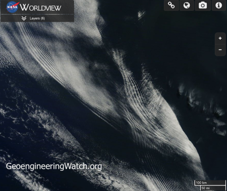
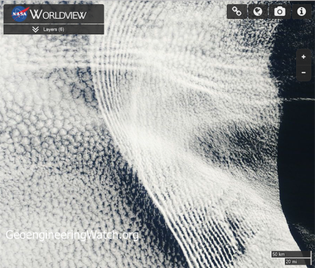
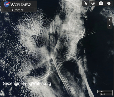
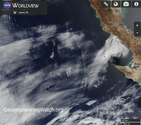
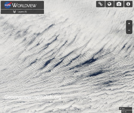
As the saying goes, a picture is worth a thousand words. The photo images shown below were captured from NASA satellite sources, they are truly alarming. These images provide shocking and undeniable proof of the ongoing global climate engineering/geoengineering/solar radiation management assault on our planet and its life support systems. Highly toxic heavy metals and chemicals (that are systematically sprayed into our atmosphere from jet aircraft as part of the geoengineering/SRM programs) are manipulated with extremely powerful radio frequency signals. These signals are transmitted from countless locations around the globe from various types of transmission platforms (ionosphere heater installations like HAARP, SBX radar, NEXRAD, etc.). The impact of the microwave transmissions on cloud formations is profound and highly visible (square cloud formations are created under some scenarios).
In the series of NASA satellite images below, many variances of radio frequency cloud impacts can be observed. The degree to which the ongoing climate engineering/climate/intervention/weather warfare is disrupting Earth’s atmosphere and life support systems is already beyond catastrophic and happening all over the globe.
Click to enlarge any of the images below
Off of east coast of Australia
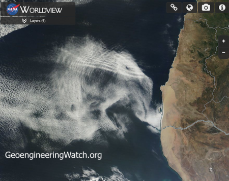
West coast of Africa
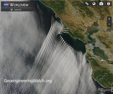
California coast
Off of Africa’s west coast
Off of Africa’s west coast
Off of Africa’s west coast
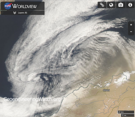
South of Spain in the Alboran Sea
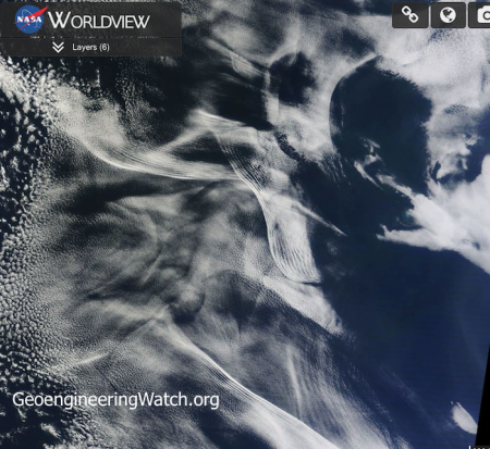
Off of Africa’s west coast
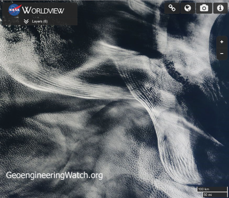
Off of Africa’s west coast
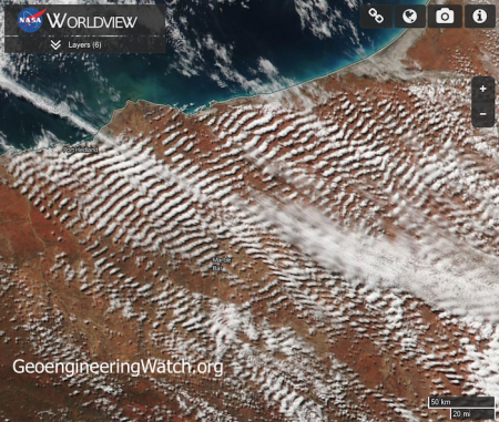
The northwest coast of Australia
Off of Africa’s west coast
Off of Africa’s west coast
Eastern Pacific ocean west of Baja California
The Southern Ocean near Antarctica
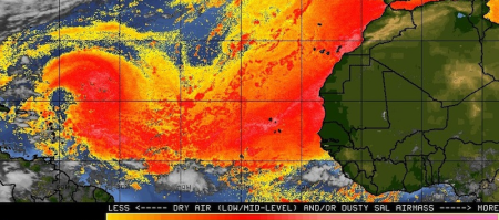
Hurricane suppression/manipulation is one aspect/agenda of the climate engineers. 85% of the hurricanes that impact the US originate from Africa. Low pressure systems migrate toward the west, off of Africa’s coast. A great deal of climate engineering/intervention takes place in this region, thus a number of the satellite images shown in this post were captured there. In the attempt to mask the climate intervention activity, the cyclone suppression occurring off the coast of Africa is officially blamed on “dust”. Of course there is no acknowledgement of the ongoing climate engineering atrocities. The quote below is an excerpt from a FOX news article.
Right now, much of the Gulf of Mexico and parts of the Caribbean have slightly warmer than normal ocean temperatures which would normally aid in tropical development. But there is so much dust and dry air in the atmosphere that storms are getting choked off before they even get started.
Though some may feel that cyclone suppression is beneficial, such interference with Earth’s natural rhythms and systems has a long list of catastrophic downstream effects. Available data indicates that in other scenarios the climate engineers are actually augmenting and steering cyclones to serve their own agenda. “Hurricane Matthew” may be an example of weather warfare on an unimaginable scale. Is hurricane Matthew being heavily manipulated and steered by the climate engineers? The evidence continues to stack up. Below is a satellite photo clearly showing atmospheric “waves” surrounding hurricane Matthew. SpaceWeather.com has labeled these as “gravity waves”, but is that what these visible “waves” actually are? The satellite photos already shown in this post inarguably reveal heavy atmospheric manipulation from extremely powerful radio frequency/microwave transmissions and atmospheric aerosols. These transmissions leave a signature pattern on high level cloud formations that are saturated with electrically conductive heavy metal nanoparticles which are dispersed from jet aircraft as part of the ongoing climate engineering insanity.
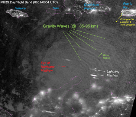
Does the photo above really show “gravity waves” surrounding hurricane Matthew? Or does it show the signiture pattern of extremely powerful radio frequency/microwave transmissions interacting with aircraft dispersed atmospheric aerosols? Both of these elements are a core part of climate and storm manipulation and steering. Photo: SpaceWeather.com
The global power structure long ago made the choice to subject our planet (and the entire web of life that it supports, including the human race) to an unimaginably massive and destructive climate intervention/weather warfare assault. This decision was made without the knowledge or consent of global populations. If we stand by and allow the decimation from the climate engineering insanity to continue, very soon Earth’s life support systems will be beyond any recovery. This is not speculation, but a mathematical certainty. Help us with the most critical battle to expose and halt the climate intervention/weather warfare assault, all of us are needed in this fight.
DW
【転載終了】
【Bing仮訳開始】※そのママ