My fact finding mission (July 2016) to General Santos, Mindanao, led to the discovery that the sea route between General Santos and Bitung, northern Sulawesi now remains closed.
That sheds a new light on Ambon and the three seas around it. What follows is what it now looks like in terms of access to it, either by sea or by air, as seen from Tokyo.

This huge area contained in the square in red is no longer easily accessible from the north, except the (mainly) sea routes stretching from the tip of Zamboanga, to Sandakan, northern Borneo, then down south to Makassar and beyond.
This entire area then is effectively also closed off and self-contained to all intents and purposes.
Therefore, the more I think about it and gaze at it and the more so historically and in access terms the more strikingly felt must be the presence of Ambon right in the middle.
Perhaps, it was just like that centuries ago. It must have been and it still is, by the look of it. I must go and visit Ambon and spend time on it both in terms of pre-reading and activities on the island.
Quite how I might go about it is unclear to me at this moment in time.
Will I be flying out to Denpasar? Will I be arriving at Surabaya and take a slow boat from there into the region? and then what...
One thing is certain, though. I must spend time on this island, and explore it up and down the entire area, perhaps on a motor bike, or by car. How would that relate to Pelni boats? I am unsure.
Let us take a closer look, before going any further and see below.

I can easily recognise five key places and the three seas.
Buton in the south, and clockwise, Bitung, Ternate, Sorong, and Tual down at the bottom. Pelni go to all of these places, but not in one single operation, I think.
That is where diffculties arise and that is where the Pelni time table at the top of this article plays an important role in decision making ultimate.


 この画像はフェリ-乗り場を見た時に背後に位置する教会だ。その時に右側に見えるのが次の画像の建物になる。
 こちらは礼拝堂だ。
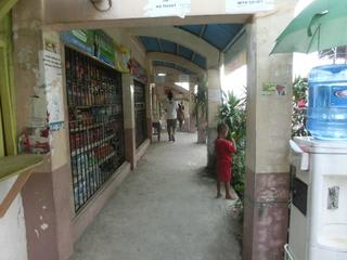
 奥に見えるのがセブ島だ。真ん中に見える水色の屋根状のものが通路で、乗船客専用になっている。この通路の途中で切符を買う仕組みだ。
 既に切符を持っている乗客は右側、これから切符を買う乗客は左側に並ぶ仕組みで、今来た通路を振り返ると次のように見える。当然、どうやったら切符を事前に手に入れることが出来るのか気になるが、判らない。
 仕切り用のロ-プが見えると思う。で、この通路の途中で切符、確か25ペソだったと思うが、それに港の使用料、5ペソ?、を払うと、その時点で2枚の切符を持っていることになる。
 入船するフェリ-。メトロフェリ-と書かれている。
 ここから待合所に出てくる仕組みだ。
 この係員が待機している場所のア-チが出口になる。


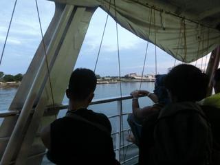
 セブ方面、すでに夕方。
 マクタン側を見ている乗客。短い動画が以下のURLにある。
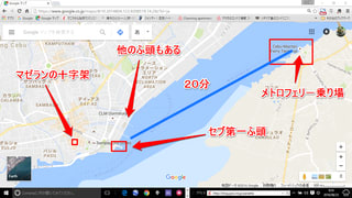
 セブについて岸壁を歩いている乗客達。メトロフェリ-が到着するのはセブ第一ふ頭だ。大通りまではここから200m程で、途中で構内を仕切るゲ-トがあるが、ただの通過場所で、何かを求められる訳ではない。