Killer Floods (PART 1)
(flood03.jpg)
(flood01.jpg)
(flood02.jpg)

(diane02.gif)
Kato... did you see one of those killer floods in Japan?

(kato3.gif)
Oh yes, I have seen several.
You gotta be kidding...
Well..., if you don't believe me, take a look at the following video clip.
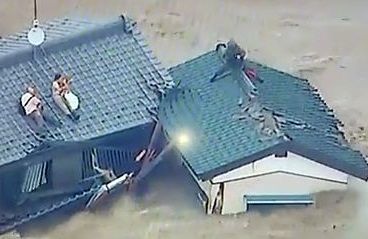
(flood04.jpg)

I see... So you were one of those people who were waiting for help on the roof top, huh?

No, I was not... 'cause I was in Vancouver at the time.
Then how come you picked up Killer Floods for today's article.
Diane, you forgot the recent flood at Grand Forks, didn't you?
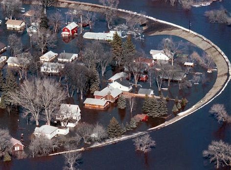
(flood05.jpg)

Of course, I remember... I've watched the news quite often...
Hot weather in the forecast
could cause more flood woes in B.C.
(flood06.jpg)
By The Canadian Press
Fri., May 11, 2018
VANCOUVER
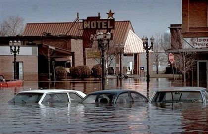
An emergency operations official in southern British Columbia says a forecast of warm weather has residents bracing for the possibility of more flooding from melting snow while at least one town starts bailing out.
Damage from torrential rain has already had a “catastrophic” impact on the community of Grand Forks, said Chris Marsh of the Regional District of Kootenay Boundary.
Torrential rains that pushed southern British Columbia waterways to flood stage have eased, but officials warn the new threat of unseasonable heat could rapidly melt snowpacks, adding to already swollen rivers, such as the Kettle River in Almond Gardens, B.C.
“The effects from this event will be long lasting,” said Marsh. “We’re talking years and years and million of dollars.”
SOURCE: Flood in B.C., Canada

So, Kato, you were almost drowned at Grand Forks, weren't you?

Oh no, I was not... 'cause I was not staying in Grand forks at the time.
Then, how come you jotted down Killer Floods as the above title?
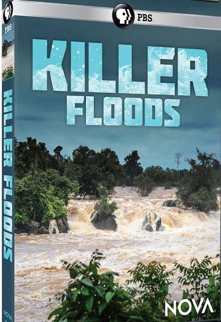
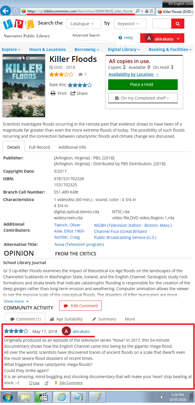
Good question! Actually, I viewed a DVD called "Killer Floods" at Vancouver Public Library.
(lib80517a.png)
■"Enlarge!"
■"Actual Page"

My Comment
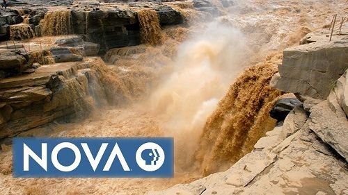
Originally produced as an episode of the television series "Nova" in 2017, this 54-minute documentary shows how the English Channel came into being by the gigantic mega-flood.
All over the world, scientists have discovered traces of ancient floods on a scale that dwarfs even the most severe flood disasters of recent times.
What triggered these cataclysmic mega-floods?
Could they strike again?
It is an amazing, mind-boggling and shocking documentary that will make your heart stop beating at once.

(laughx.gif)

I see... So, Kato, you viewed the above documentary on May 17, huh?

Yes, I did.
As soon as you saw the gigantic mega-flood create the English Channel, your heart stopped beating, huh?
Yes, my heart almost stopped beating, that's why I jotted down Killer Floods as the title for today's article.
But how could a giant flood possibly create the English Channel?
Well, if you really want to know it, you should see the following full documentary.
(flood07.jpg)
Geological origins:
giant waterfalls and catastrophic floods
(flood08.jpg)
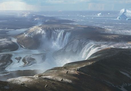
English Channel before the Megaflood
The Channel is of geologically recent origin, having been dry land for most of the Pleistocene period.
Before the Devensian glaciation (the most recent ice age, which ended around 10,000 years ago), Britain and Ireland were part of continental Europe, linked by an unbroken Weald-Artois Anticline, a ridge that acted as a natural dam holding back a large freshwater pro-glacial lake in the Doggerland region, now submerged under the North Sea.
During this period the North Sea and almost all of the British Isles were covered by ice.
The lake was fed by meltwater from the Baltic and from the Caledonian and Scandinavian ice sheets that joined to the north, blocking its exit.
The sea level was about 120 m (390 ft) lower than it is today.
Then, between 450,000 and 180,000 years ago, at least two catastrophic glacial lake outburst floods breached the Weald–Artois anticline.
The first flood would have lasted for several months, releasing as much as one million cubic metres of water per second.
The flood started with large but localized waterfalls over the ridge, which excavated depressions now known as the Fosses Dangeard.
The flow eroded the retaining ridge, causing the rock dam to fail and releasing lake water into the Atlantic.
After multiple episodes of changing sea level, during which the Fosses Dangeard were largely infilled by various layers of sediment, another catastrophic flood carved a large bedrock-floored valley, the Lobourg Channel, some 500 meter wide and 25 meter deep, from the southern North Sea basin through the centre of the Straits of Dover and into the English Channel.
It left streamlined islands, longitudinal erosional grooves, and other features characteristic of catastrophic megaflood events, still present on the sea floor and now revealed by high-resolution sonar.
Through the scoured channel passed a river, which drained the combined Rhine and Thames westwards to the Atlantic.
The flooding destroyed the ridge that connected Britain to continental Europe, although a land connection across the southern North Sea would have existed intermittently at later times when periods of glaciation resulted in lowering of sea levels.
At the end of the last glacial period, rising sea levels finally severed the last land connection.
SOURCE: "English Channel" (Wikipedia)

Wow!... I can hardly believe this.

Well..., Here's a Japanese old saying: 天災は忘れた頃にやって来る.
What does that mean?
It means: Disaster strikes when you least expect it.
Kato, do you really mean that we'll see a mega flood in the future?
Well..., God only knows.

(dianelin3.jpg)

(laughx.gif)
(To be followed)


