


2015年12月09日 間瀬ダム
2019年 4月13日
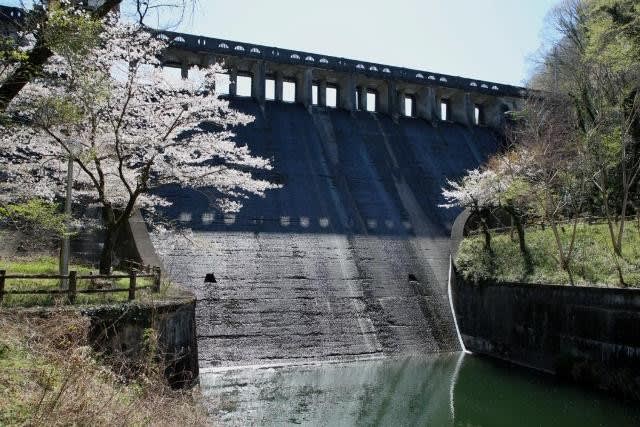
間瀬(まぜ)ダムは埼玉県本庄市児玉町小平の利根川水系神流川右支流間瀬川上流部にある灌漑目的の重力式コンクリートダムです。
戦前埼玉県の事業により建設されましたが、竣工年度についてはダム便覧では1936年(昭和11年)、ダム親柱の銘版では1937年(昭和12)と1年のずれがあります。
管理は美児沢用水土地改良区が管理を行っています。
正確には東日本最古の農業用コンクリートダムであり、型枠によって建設された農業用コンクリートダムとしては日本最古という表現が正しいものになります。
いずれにしても土木建築物としては貴重なダムであることは間違いなく、2000年(平成12年)に国の有形文化財に登録された、近代土木遺産、日本100ダムに選定されています。
貯水池の間瀬湖は関東有数のヘラブナ釣りスポットとなっており季節を問わず多くの釣師が訪れるほか、桜の名所としても知られています。
本庄児玉インターから国道462号を南下し、旧児玉町中心街から県道44号に入りさらに県道287号を南下すると間瀬ダムに到着します。
初回訪問時は晩秋、2度目は桜満開の時期での訪問となりました。
黒く着色したコンクリートが歴史を感じさせます。

浮き出た打継面、落ち葉と白糸のような細い流水が何とも言えない哀愁を漂わせ晩秋の景色とマッチしています。

2度目の訪問は春爛漫、桜満開の時期となりました。
(2019年4月13日)
苔むした導流壁

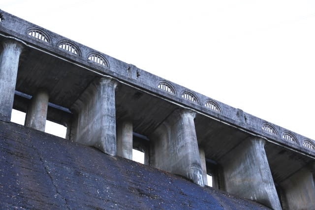
洪水吐の扶壁の配置や高欄のデザインも凝っています。
取水設備からの樋門(2019年4月13日)

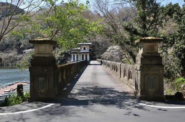
天端と親柱 天端は車両通行可能です。(2019年4月13日)
昭和拾二年竣工の銘板、ダム便覧の竣工年度とは1年ずれています。
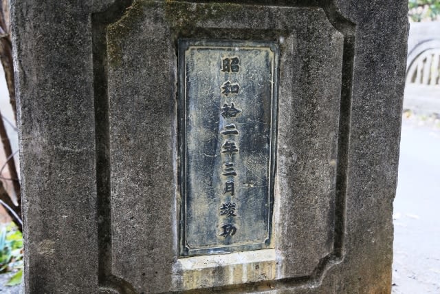
銘板では間瀬堰堤となっています。(2019年4月13日)

手が込んだ天端高欄。

ぱっと見ると本物の木の幹が使われているよう。


取水設備建屋はどこかの文豪の別荘みたいな雰囲気
(2019年4月13日)

導流壁と減勢工、桜満開です。(2019年4月13日)

天端から見下ろした減勢工と水路(2019年4月13日)

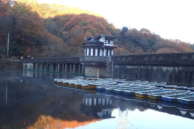
貯水池の間瀬湖は総貯水容量53万立米
間瀬湖は管理釣場となっており関東有数のヘラブナ釣りスポットとして知られています。
(2019年4月13日)

取水設備は戦前のダムらしく半円形
釣り用の貸しボートが並びます。
下流の管理橋
堰堤ともども有形文化財に登録されています。
左側は灌漑用水路へのゲートになります。(2019年4月13日)

登録有形文化財のプレート(2019年4月13日)

晩秋と春爛漫、全く雰囲気の異なる季節に訪問しましたが、どの季節も似合う古い名堤です。
(追記)
間瀬ダムは洪水調節容量を持たない利水ダムですが、治水協定により台風等の襲来に備え事前放流を行う予備放流容量が配分されました。
0633 間瀬ダム(0098)
埼玉県本庄市児玉町小平
利根川水系間瀬川
A
G
27.5メートル
126メートル
美児沢用水土地改良区
1936年
◎治水協定が締結されたダム