


2015年10月31日 塩田ダム
2016年12月11日
塩田ダムは栃木県矢板市塩田の那珂川水系簗目川上流部にある灌漑目的のロックフィルダムです。
農水省の補助を受けた栃木県の事業により1987年(昭和62年)に本体工事が着工され、13年後の2000年(平成12年)に竣工しました。
運用開始後は矢板市が管理を受託しています。
なお高原山東山麓の塩谷町から矢板にかけての那珂川水系には塩田ダムを含め4基のダムが近接していますが、他の三ダムが栃木県営でダムカードを配布しているのに対し、塩田ダムはカードの配布がないせいか訪問者も少なく静かなたたずまいを残しています。
下流から遠望。(2016年12月11日)

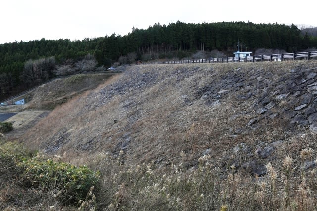
下流面。

洪水吐と取水口からの導水路
堤体直下で合流します。

取水口からのトンネル導水路吐口
河川維持放流が行われています(2016年12月11日)。

下流面(2016年12月11日)。
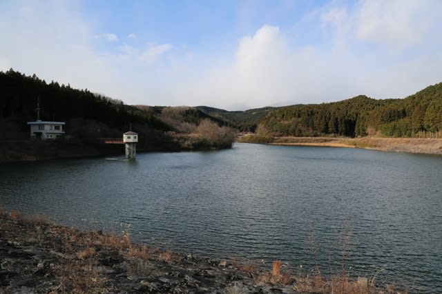
上流面
右岸に取水塔と管理事務所があります(2016年12月11日)。

天端は徒歩のみ開放されています。(2016年12月11日)。

総貯水容量46万立米の貯水池(2016年12月11日)。
取水棟(2016年12月11日)。

右岸の横越流式洪水吐(2016年12月11日)。

洪水吐導流部
洪水吐の隣に東屋があります(2016年12月11日)。

下流はのどかな田園風景です。
この眺めは栃木のふるさと田園風景100選に選ばれています(2016年12月11日)。

0573 塩田ダム(0029)
栃木県矢板市大字塩田
那珂川水系簗目川
A
R
21.6メートル
218メートル
460㎥/380㎥
矢板市
2000年