


2024年8月18日(日)

まだ暗いため、1時間ほど車内で仮眠する。
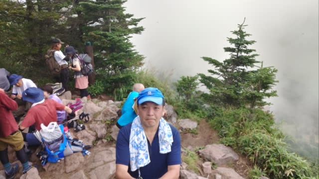
お盆休み最終日でも来る人は多い。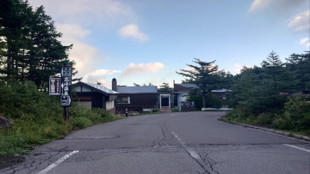

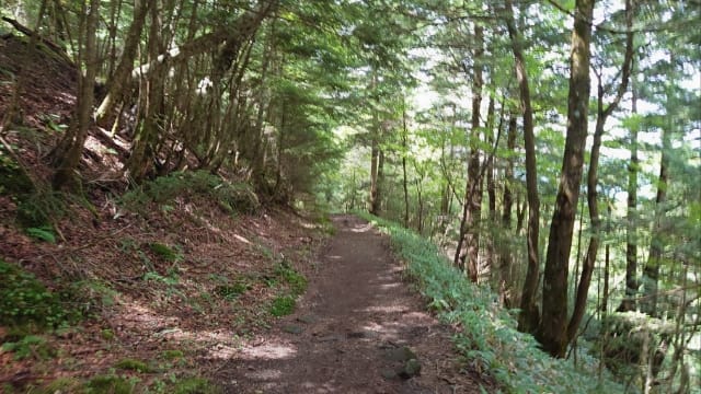
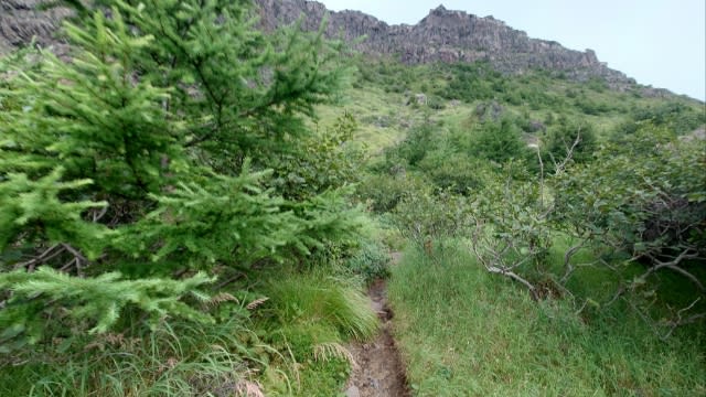
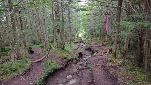
序盤はフラットな道のり。
徐々にアップダウンして行き。。。

途中から上り調子。

出発時は肌寒く薄手ジャケットを着ていたが、今は半袖一枚が丁度良い。

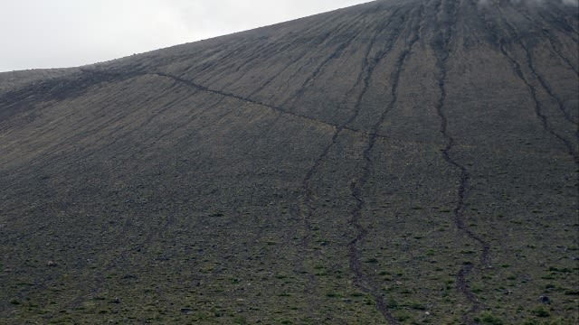
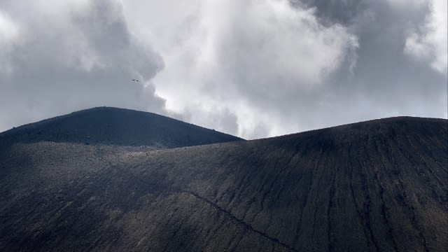
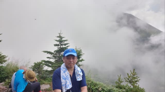
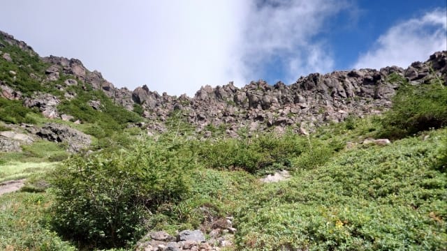
雲がどんよりする中、少し景色が見えた。
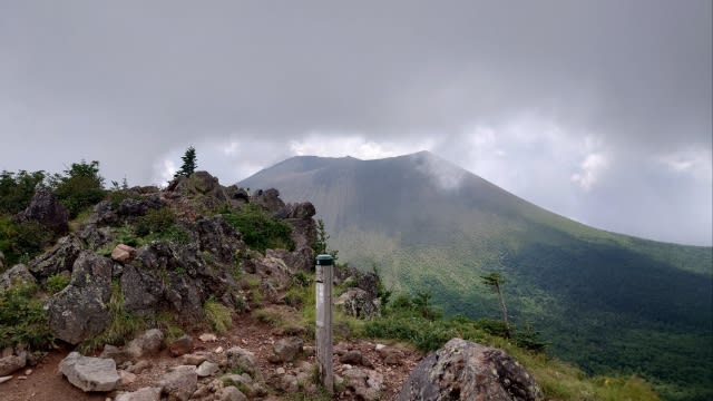
7時11分 槍ヶ鞘(やりがさや)に到着。
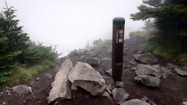
景色は真っ白。。。
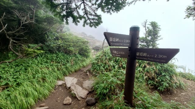
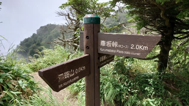
2分ほどで中コースとの合流地点↓
この先の道のりは真っ白。

浅間山は見えるのか。。。
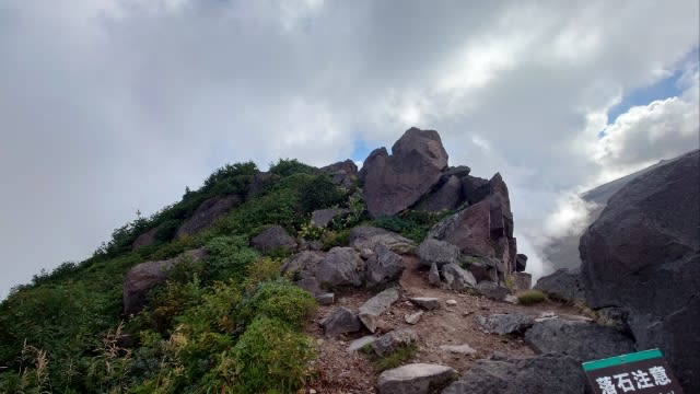
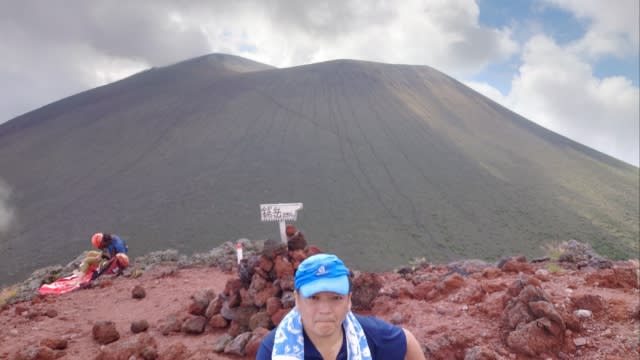
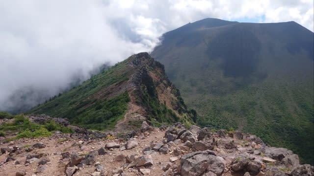
7時20分 トーミの頭に到着。

草すべりを下って行く。
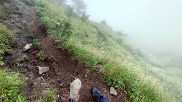
道は狭く、すぐ端は切れており、草に隠れた小岩に油断して両ひざを打った。


少し歩くと左手には外輪山↓

そして右手には浅間山↓
見えたのは嬉しい。
![]()
規制緩和されるのはいつになるやら。
賽の河原で少し休憩。

これから急登を登るため、水分補給とアミノバイタルも補給。
そして。。。
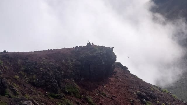
この先には"鋸岳(のこぎりだけ)"↓
目指すは"黒斑山"だがもちろん寄って行く。
![]()

よく見ると誰かいる。
さっき登っていた人だろうか。
ここは浅間山外輪山の中で一番端になる。
浅間山頂にズーム↓
奥が浅間山で手前が前掛山かな。

岩場が多いためグローブを着けると安心。
メットがあればより安心だが、なくても大丈夫だった。
晴れていればもっと見応えがありそう。
稜線を歩く人にズーム↓
ナイフエッジなルートはスリルがある。

ふらつかなければ大丈夫。

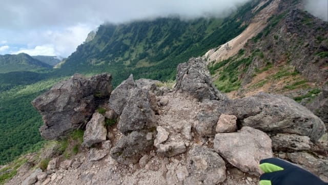
ちょっとしたピークがいくつか続く。
目指すはあの頂き↓
そして。。。
歩いてきた道を振り返る↓
晴れていればもう少し景観もイイだろう。
次の"蛇骨岳"へ向け出発。
左側はスリルがある↓
9時56分 蛇骨岳に到着。
そして再びガスで周囲は真っ白に。
浅間山はさっき見れたしヨシとしよう。

↑草すべりとの分岐を通過し。。。
しばらくして開けた場所↓
見晴らしは良いが暑い。
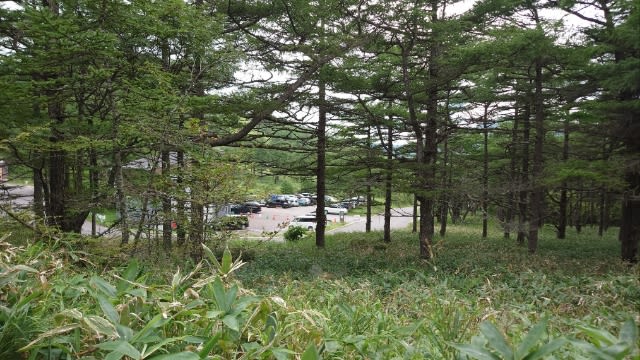
最後はフラットな道のり。
駐車場が見えてきた↓
そして。。。
14時10分 信州健康ランドに到着。

今回の登山データ。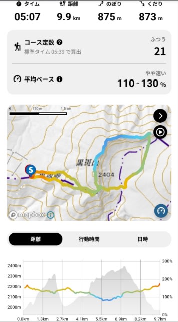
以前から行ってみたかった"浅間山"
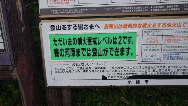
しかし浅間山は活火山であり、今は噴火警戒レベルが2のため、火口はもちろん手前の前掛山にも入れない。
半径2km以上離れていれば大丈夫なので、今回は浅間山外輪山をハイクしてみた。
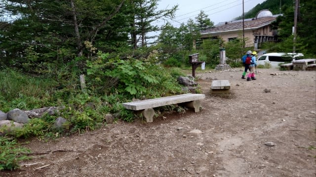
0時過ぎに自宅を出発し、一般道でR20>R141を経由し、登山口のある"高峰高原ビジターセンター"に着いたのは4時30分。
まだ暗いため、1時間ほど車内で仮眠する。
5時半に起き、サンドイッチで朝食。

そして出発準備↓

そして出発準備↓
ビジターセンターの駐車場は、6時前には8割ほど埋まっていた。
お盆休み最終日でも来る人は多い。
早めに来ておいて良かった。
ビジターセンターはまだ開いておらず、トイレは高峰高原ホテル横の奥にあった↓
(↑左がホテル/トイレは道の奥)
ここ"車坂峠"は群馬県と長野県の境界。

周辺マップ↓
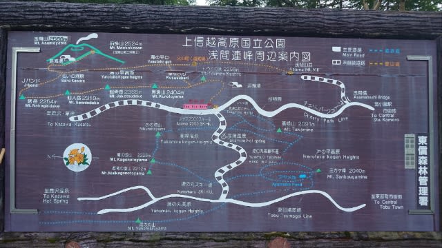
浅間山と外輪山の位置関係↓
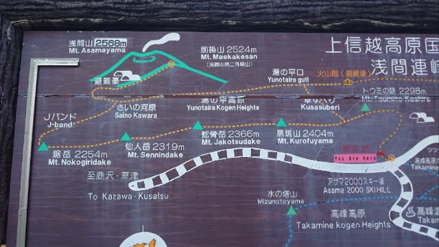
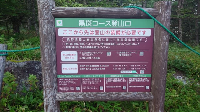
登山口は黒斑(くろふ)コース。
外輪山で一番標高が高い"黒斑山"がピーク。
周辺マップ↓
浅間山と外輪山の位置関係↓
登山口は黒斑(くろふ)コース。
外輪山で一番標高が高い"黒斑山"がピーク。
6時15分に車坂峠を出発。

登山口からのコースは2通りあり、上りは"表コース"で登る。

登山口からのコースは2通りあり、上りは"表コース"で登る。
もう1つの"中コース"は下山で利用。
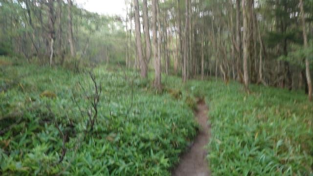
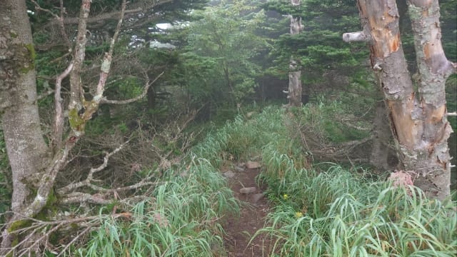
序盤はフラットな道のり。
徐々にアップダウンして行き。。。
途中から上り調子。
出発時は肌寒く薄手ジャケットを着ていたが、今は半袖一枚が丁度良い。
途中で開けた場所↓
雲がどんよりする中、少し景色が見えた。
7時11分 槍ヶ鞘(やりがさや)に到着。
景色は真っ白。。。
2分ほどで中コースとの合流地点↓
約1時間ほど掛かった。
この先の道のりは真っ白。
浅間山は見えるのか。。。
7時20分 トーミの頭に到着。
一向に視界が悪い。
真っ直ぐ進むと思ったら、マップを確認すると左に折れる様子。
こっちだった↓
油断するとルートを見失うので、常にマップを見るようにしているが、それでも迷う時はある。
3分ほどで草すべりとの分岐↓

黒斑山まであと400mだが、外輪山から回ってくるとこの草すべりが急登らしく、最後の上りはキツいと予想し、先にこちらのルートを選択。
こっちだった↓
油断するとルートを見失うので、常にマップを見るようにしているが、それでも迷う時はある。
3分ほどで草すべりとの分岐↓
黒斑山まであと400mだが、外輪山から回ってくるとこの草すべりが急登らしく、最後の上りはキツいと予想し、先にこちらのルートを選択。
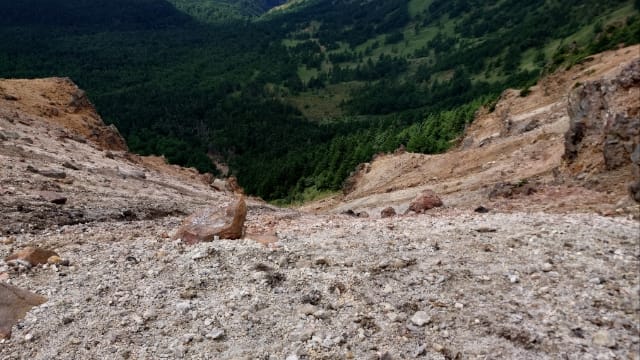
草すべりを下って行く。
道は狭く、すぐ端は切れており、草に隠れた小岩に油断して両ひざを打った。
両手や尻を着かないと厳しい箇所もあり、上りでの草すべりは確かにキツそう。
ひざパットが欲しい。
草は湿っており足元も濡れ、スパッツを着けておけば良かったと後悔。
30分ほどで草すべりを下る。

結構ひざにくるので、太ももに負荷を掛け下った。
しばらくは緩やかな下りが続く。
右手には自然豊かな景色。

ちょうど谷間にいる。
しばらくしてお花畑↓
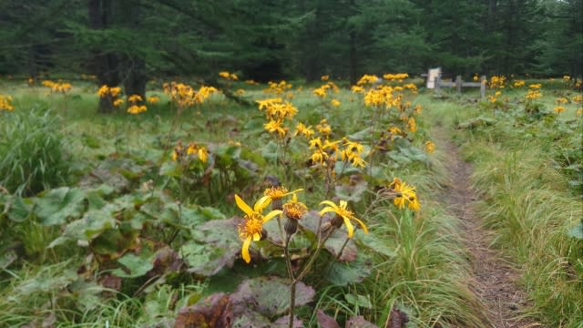
頑張ったあとは気持ちが和む。
ちょうど谷間にいる。
しばらくしてお花畑↓
頑張ったあとは気持ちが和む。
7時55分 湯の平に到着。

右手には火山館があり、左手が賽の河原。

そのまま賽の河原を目指す。
右手には火山館があり、左手が賽の河原。
そのまま賽の河原を目指す。
しばらくはフラットな道のり。

体力も回復。
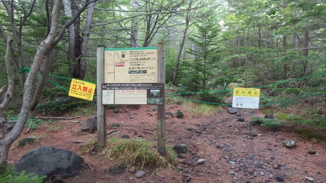
8時12分 賽の河原分岐に到着。

ここは浅間山(前掛山)への分岐点。
体力も回復。
8時12分 賽の河原分岐に到着。
ここは浅間山(前掛山)への分岐点。
もちろん規制で入れない。
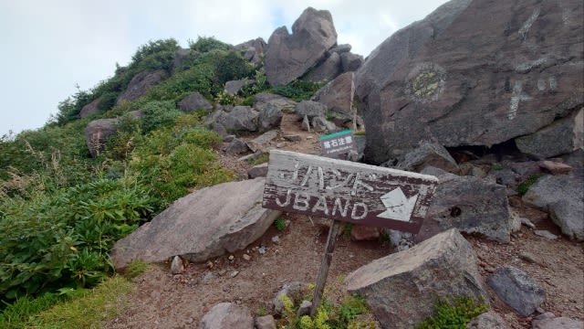
Jバンド方面へ進む。
Jバンド方面へ進む。
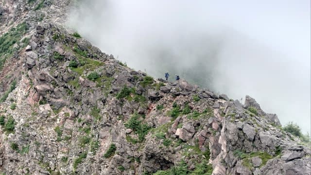
少し歩くと左手には外輪山↓
多くの人は向こうのルートだろうか。
そして右手には浅間山↓
見えたのは嬉しい。
Jバンドと呼ばれるルートはあの山辺りか。

どういう意味だろう。
どういう意味だろう。
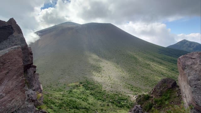
浅間山が更に良く見えてきた。
前掛山への登山ルートが分かる↓
規制緩和されるのはいつになるやら。
賽の河原で少し休憩。
これから急登を登るため、水分補給とアミノバイタルも補給。
まだ早いためか周りに人はいない。
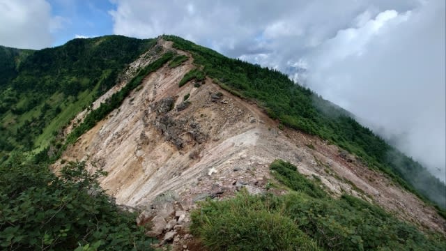
8時30分 Jバンドに向け出発。
この壁のような岩肌のどこを登るのか。。。
よく見ると先に登る人がいた↓

なるほど。
登り進むと意外と問題なく、道幅は広くないが富士登山と似たようなザレ場や、時には両手を使った岩登りもあった。
途中で振り返る↓

(先ほどは写真中央の大岩辺りで休憩した)
疲れているが、草すべりの下山と賽の河原の道のりで体力も回復し何とか頑張れそう。
この壁のような岩肌のどこを登るのか。。。
よく見ると先に登る人がいた↓
なるほど。
登り進むと意外と問題なく、道幅は広くないが富士登山と似たようなザレ場や、時には両手を使った岩登りもあった。
途中で振り返る↓
(先ほどは写真中央の大岩辺りで休憩した)
疲れているが、草すべりの下山と賽の河原の道のりで体力も回復し何とか頑張れそう。
登山前に体力づくりをすべきなのに、またサボってしまったが。。。
そして。。。
8時51分 稜線に出る。
あとは稜線歩きだけ。
あとは稜線歩きだけ。
この先には"鋸岳(のこぎりだけ)"↓
目指すは"黒斑山"だがもちろん寄って行く。
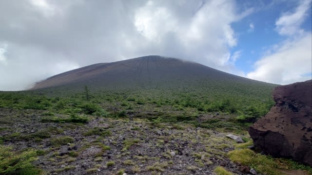
ここから見る"浅間山"↓
富士山のような裾野の広がりがキレイ。
富士山のような裾野の広がりがキレイ。
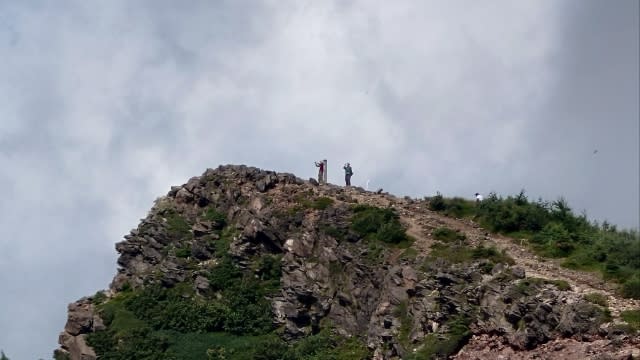
鋸岳はあの辺り(写真中央)↓
よく見ると誰かいる。
さっき登っていた人だろうか。
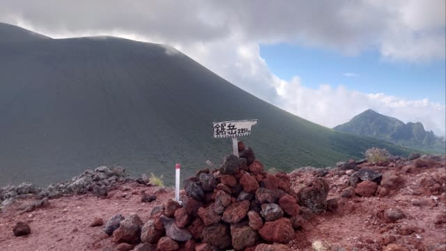
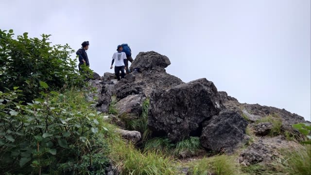
8時55分 鋸岳に到着。
ここは浅間山外輪山の中で一番端になる。
浅間山をバックに。。。
雲がなくなり、タイミングが良い。
浅間山頂にズーム↓
奥が浅間山で手前が前掛山かな。
いつか行ってみたい。
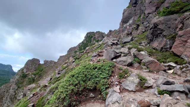
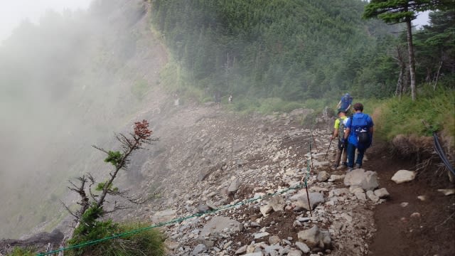
ここから外輪山稜線を渡り歩く。
ただ上り調子な感じ。
さっき休んだ場所にズーム↓

皆さん考える事は同じ(•‿•)
ここから外輪山稜線を渡り歩く。
ただ上り調子な感じ。
さっき休んだ場所にズーム↓
皆さん考える事は同じ(•‿•)
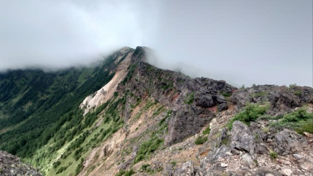
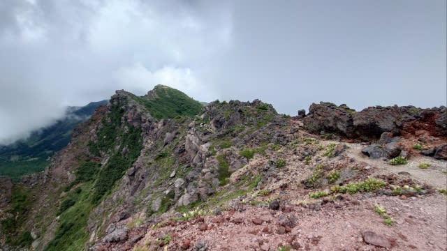
眺めは最高。
岩場が多いためグローブを着けると安心。
メットがあればより安心だが、なくても大丈夫だった。
晴れていればもっと見応えがありそう。
稜線を歩く人にズーム↓
ナイフエッジなルートはスリルがある。
両サイドは切れているが、道幅はそれなりにある。
ふらつかなければ大丈夫。
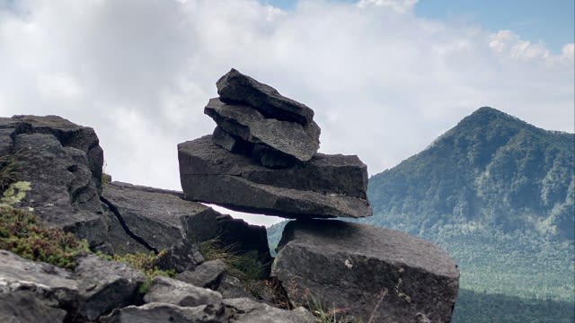
途中にあった浮いてるような岩↓
しかも積み重なり、自然の力はスゴい。
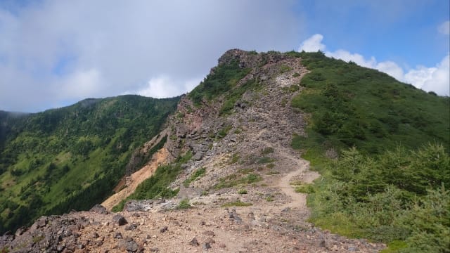
ちょっとしたピークがいくつか続く。
目指すはあの頂き↓
そして。。。
9時34分 仙人岳に到着。
浅間山をバックに。
歩いてきた道を振り返る↓
晴れていればもう少し景観もイイだろう。
次の"蛇骨岳"へ向け出発。
左側はスリルがある↓
大人しく歩けば問題ない。
9時56分 蛇骨岳に到着。
少しバテてきた。
次のピークまであと少し。
そして。。。
次のピークまであと少し。
そして。。。
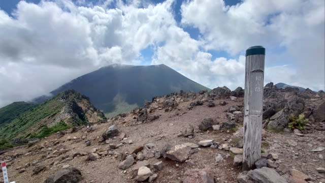
10時22分 黒斑山に到着。

ようやく到着。頑張った。
ようやく到着。頑張った。
ここまで来ると人が多い。
そして再びガスで周囲は真っ白に。
浅間山はさっき見れたしヨシとしよう。
ここでようやく腰を下ろし休憩。

周囲が賑やかな中、端っこで休む。
周囲が賑やかな中、端っこで休む。
10分ほど休憩したあとは下山。
↑草すべりとの分岐を通過し。。。
トーミの頭も通過↓
休憩したおかげで体力はある。
10時46分 表コースとの分岐。
予定通り"中コース"で下る。
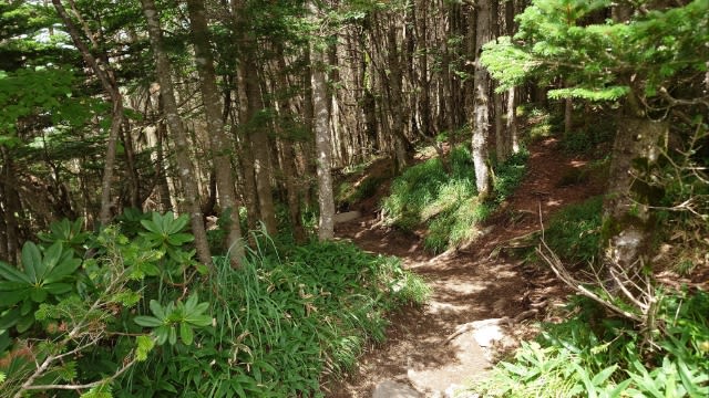
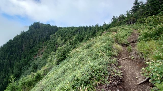
木々に囲まれたルートをひたすら下る。
休憩したおかげで体力はある。
10時46分 表コースとの分岐。
予定通り"中コース"で下る。
木々に囲まれたルートをひたすら下る。
表ルートと違いこちらはアップダウンがなく、気持ちがラク。
しばらくして開けた場所↓
見晴らしは良いが暑い。
最後はフラットな道のり。
駐車場が見えてきた↓
そして。。。
11時23分 車坂峠に到着。
予定より早かった。
駐車場は満車。

リュックを下ろし、登山靴を脱ぐ瞬間が気持ちイイ。
サンダルに履き替え、時間に余裕があるのでビジターセンターへ行ってみる。
テラスで頂くソフトクリームが美味い。

達成感を噛みしめる、このひとときが最高。
予定より早かった。
駐車場は満車。
リュックを下ろし、登山靴を脱ぐ瞬間が気持ちイイ。
サンダルに履き替え、時間に余裕があるのでビジターセンターへ行ってみる。
テラスで頂くソフトクリームが美味い。
達成感を噛みしめる、このひとときが最高。
そして、このあとは癒しの健康ランドへ。
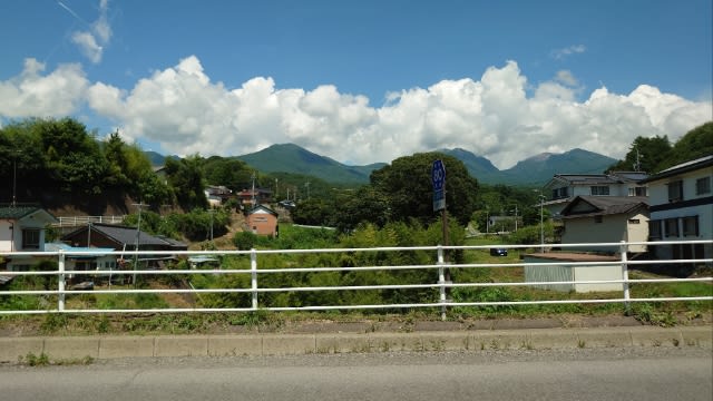
ここからR254経由で塩尻へ向かう。
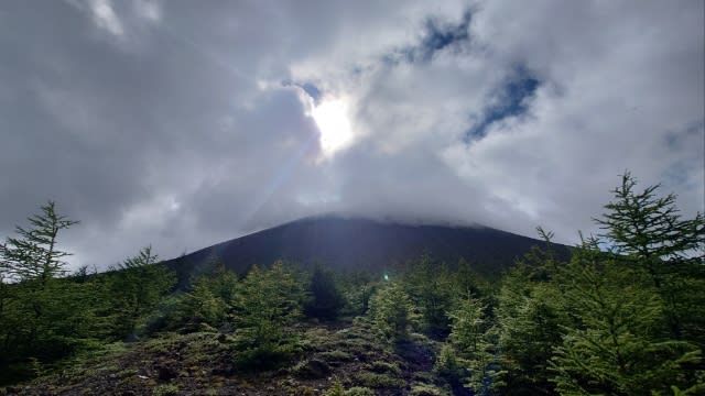
さっき登った信州の山々↓
次はスキーで行くかも。
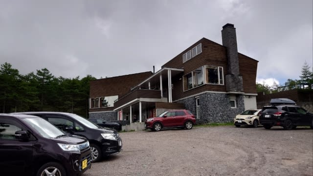
14時10分 信州健康ランドに到着。
温泉地でも良かったが、慣れたココが気兼ねなくてイイ。
チェックイン前のため、お風呂だけ先に入らせてもらい、風呂上がりに部屋で乾杯。
混む前の16時には夕食。

混む前の16時には夕食。
美味しく頂いた。
今回の登山データ。
歩行距離:9.9km
歩行時間:5:07
消費カロリー:1860kcal
06:15 車坂峠
07:11 槍ヶ鞘
07:13 中コース分岐
07:20 トーミの頭
07:23 草すべり分岐
07:55 湯の平分岐
08:12 賽の河原
08:30 Jバンド下
08:51 Jバンド上
08:55 鋸岳(2254m)
09:34 仙人岳(2319m)
09:56 蛇骨岳(2366m)
10:22 黒斑山(2404m)
10:41 草すべり分岐
10:42 トーミの頭(2298m)
10:46 表コース分岐
10:46 表コース分岐
11:23 車坂峠
運動不足でも何とか楽しめる登山だった。
次はどこへ行こうかな。

ーDankeー