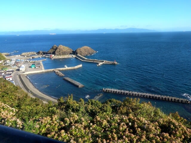
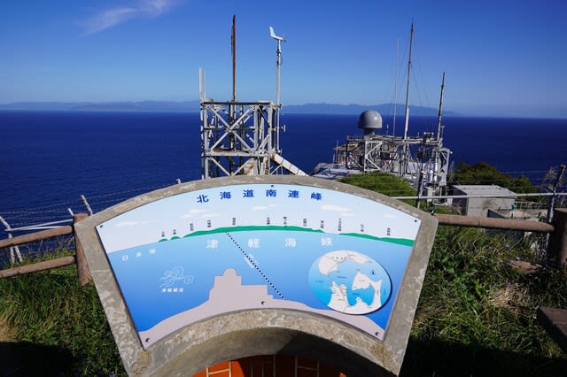
津軽半島の最北端、津軽海峡に突き出た岬である
龍飛埼(たっぴみさき)からの光景です。
北の大地が見えていますが、
北海道の白神岬とは津軽海峡を挟んで
19.5キロメートルの距離、
この地下を青函トンネルが通っています。
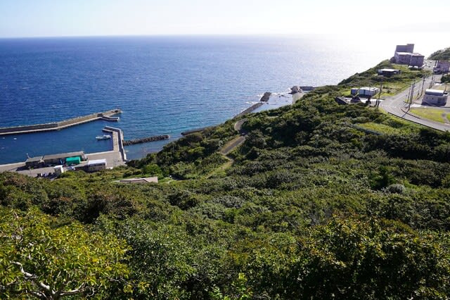
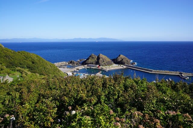
下に見えるのが竜飛漁港、主要魚種はヤリイカ、
タコ、カレイ類、ヒラメ、アンコウ、マイカ。
以前はコンブも多く獲れましたが、
最近は減少気味なのだそうです。

龍飛埼の突端に立つ白亜円形の大型灯台は、
カンデラの光量で船の安全を
見守っている龍飛埼灯台。
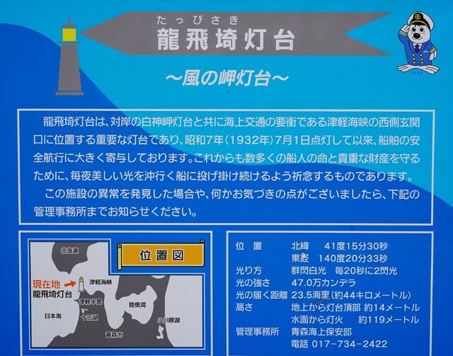
日本の灯台50選にも選ばれている
龍飛埼のシンボルです。
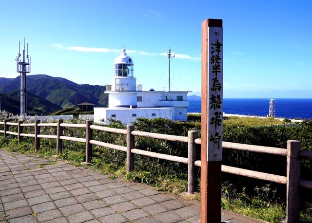
周辺は灯台を中心に遊歩道となっていますが、
「たっぴみさき」の表記は、「竜/龍」に
「崎/埼/岬」とあり、なるべく
表記通りにと思っていますが、混乱。

津軽海峡を挟んだ北海道の松前半島や、
海峡を行き交う船舶が見渡せます。
渡り鳥の飛行ルートとしても
重要であるとか。
海から1日中強い風が吹き付ける土地柄、
冬季でも降った雪が風に飛ばされ、
深く積雪することは少ないです。
この日も冷たい風が吹いており、
この光景を目に焼き付け、
バスに早く戻りたくなりました。
青森県東津軽郡外ヶ浜町字三厩龍浜
2022.9.14